Cíes Islands
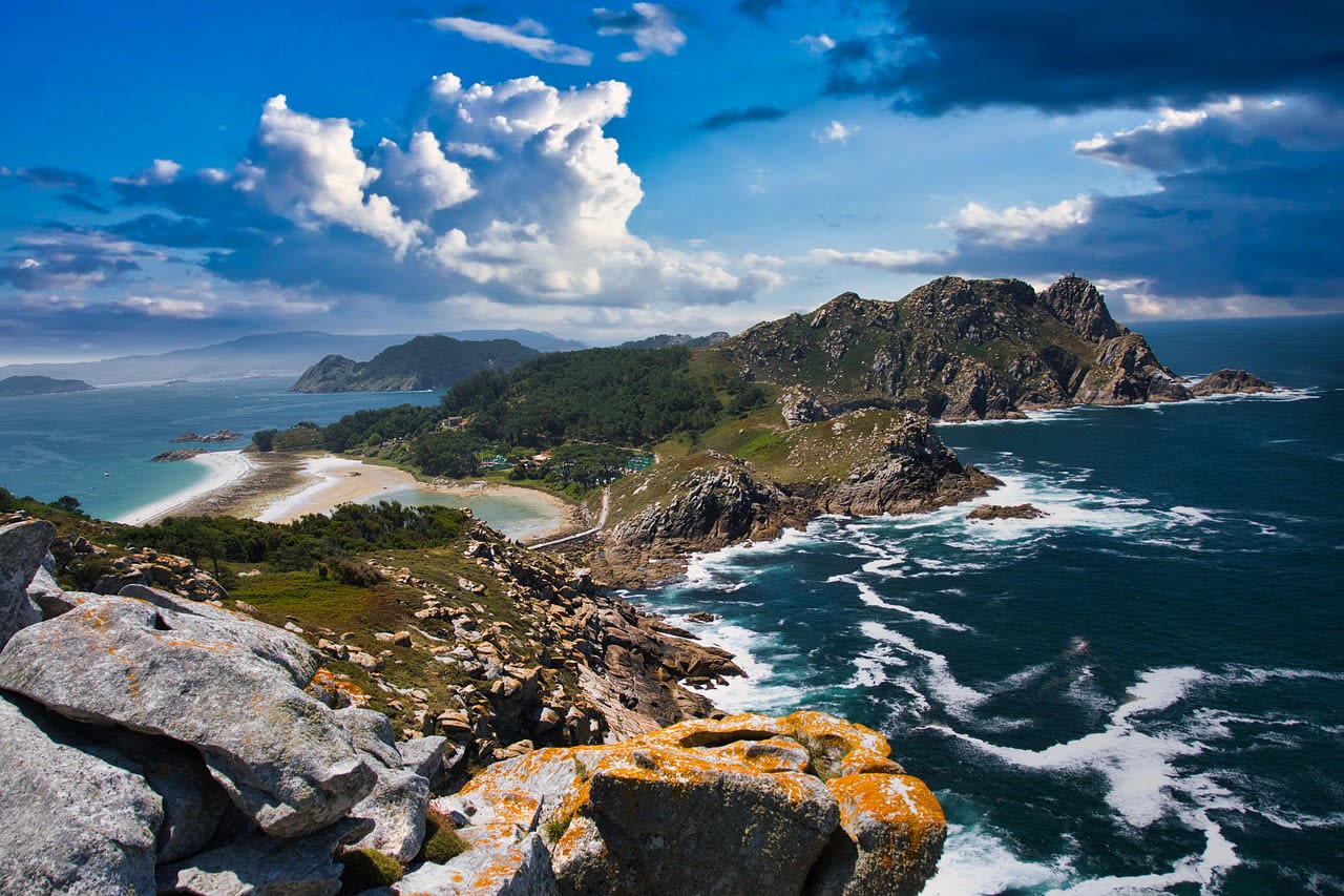
The Cíes Islands (Illas Cíes) are a small archipelago of three granite islands — Monteagudo, Faro, and San Martiño — at the mouth of the Ría de Vigo in Galicia, northwest Spain. Declared a National Park in 2002 as part of the Atlantic Islands of Galicia National Park, the Cíes combine some of the finest beaches in Europe — the Playa de Rodas was named the world's best beach by The Guardian in 2007 — with dramatic Atlantic sea cliffs, 200 species of seabirds, and an underwater environment of exceptional richness. The islands are connected by a sand spit that creates the lagoon-like shallow water of Playa de Rodas on the inner (ría) side — a sheltered, warm-watered beach of exceptional clarity — contrasting with the pounded granite cliffs and sea stacks of the ocean-facing western shore. Daily visitor numbers are strictly limited (maximum 2,200 per day) to protect the fragile ecosystem, and the islands are accessible only by scheduled ferry from Vigo, Baiona, and Cangas from April to October. No permanent habitation is permitted; the only infrastructure is a campsite, a restaurant, and the park's visitor facilities.
🌍 Geography and Ecosystem
- Playa de Rodas: The Playa de Rodas is the sandbar connecting the islands of Monteagudo and Faro — a 1.2 km beach of fine white quartz sand with water colour grading from emerald in the shallows to deep blue offshore. The beach faces the ría rather than the open Atlantic, giving it shelter from westerly swell and exceptional calm. Water temperatures reach 19–21°C in July–August — warm for Atlantic standards. The combination of white sand, still water, and dark granite forest creates a beach quality comparable to the Caribbean in a north Atlantic context.
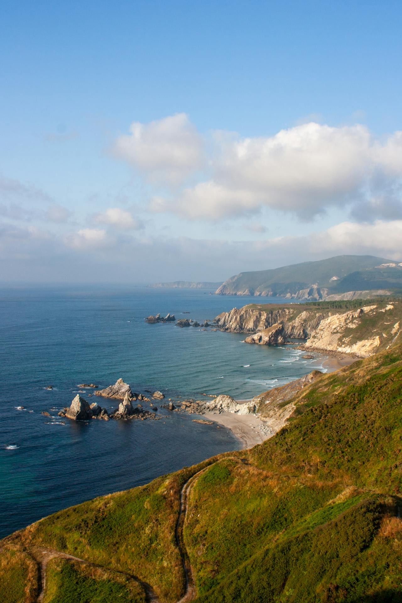
- Seabird Colonies: The Cíes support the largest yellow-legged gull colony in Spain (approximately 20,000 pairs) and significant colonies of shags, cormorants, and breeding European storm petrels. The outer cliff faces of Monteagudo island are the most biologically productive — accessible on the well-marked cliff trail (Ruta del Faro) that circles the outer coast. The cliff-top meadows in spring (April–May) are carpeted with wild flowers above nesting gull colonies.
- Marine Environment: The seabed around the Cíes — especially in the channel between the islands — contains rich beds of posidonia seagrass, diverse rocky reef habitats, and clean Atlantic water supporting populations of octopus, cuttlefish, sea bass, bream, and the occasional sunfish. The marine protected area surrounding the islands has been in place since the 1980s, and the resulting fish biomass is measurably higher than in comparable unprotected Galician waters. Snorkelling from the Playa de Rodas at its north end accesses rocky reef habitats with reasonable visibility.
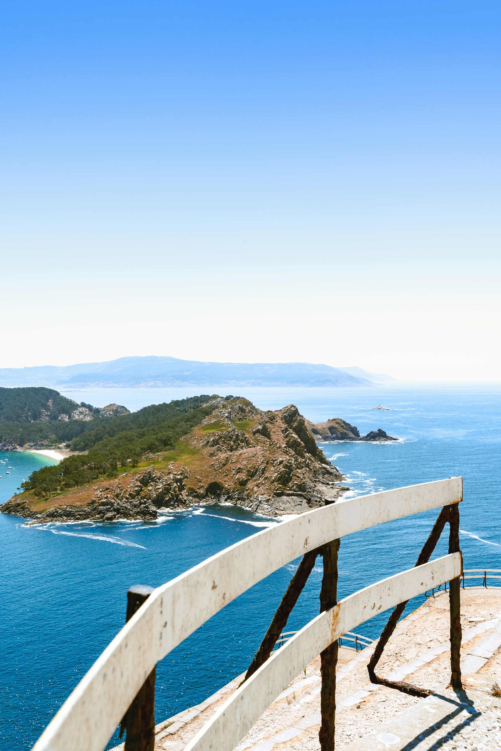
- Forest and Interior: The interior of the main two islands is covered in dense pine and eucalyptus forest — exotic plantations that have replaced the native oak scrub — threaded by hiking trails to the lighthouse on Faro island (highest point, 187 m) and the northern lookout on Monteagudo. The 200 m viewpoint above the western cliffs delivers one of the finest coastal panoramas in Galicia: the open Atlantic to the west, the ría and the Vigo city skyline to the east, and the white beach below. A restoration program is gradually replacing exotic trees with native Galician forest species.
📜 History and Cultural Significance
The islands remained uninhabited through most of the modern period, used seasonally for fishing. The last permanent residents — a handful of fishing families maintaining a lighthouse keeper's station — left in the 1970s when the islands were progressively closed to habitation in advance of national park designation. The Guardian's 2007 designation of Playa de Rodas as the world's best beach transformed visitor demand, requiring the current access restriction system — the daily permit limit of 2,200 visitors is now managed through an online booking system launched in 2019.
🏃 Activities and Attractions
- Beach Swimming: The Playa de Rodas delivers an Atlantic beach experience of Caribbean visual quality — the combination of white sand, still clear water, and dark forested cliffs behind. Arrive early (first ferry at 9:00 from Vigo) to secure space on the beach before midday crowds. The north end of the beach near the rocky point accesses shallow snorkelling terrain. Water temperatures reach 21°C in August but are cooler (16–18°C) in June and September — wetsuits are common even in midsummer.
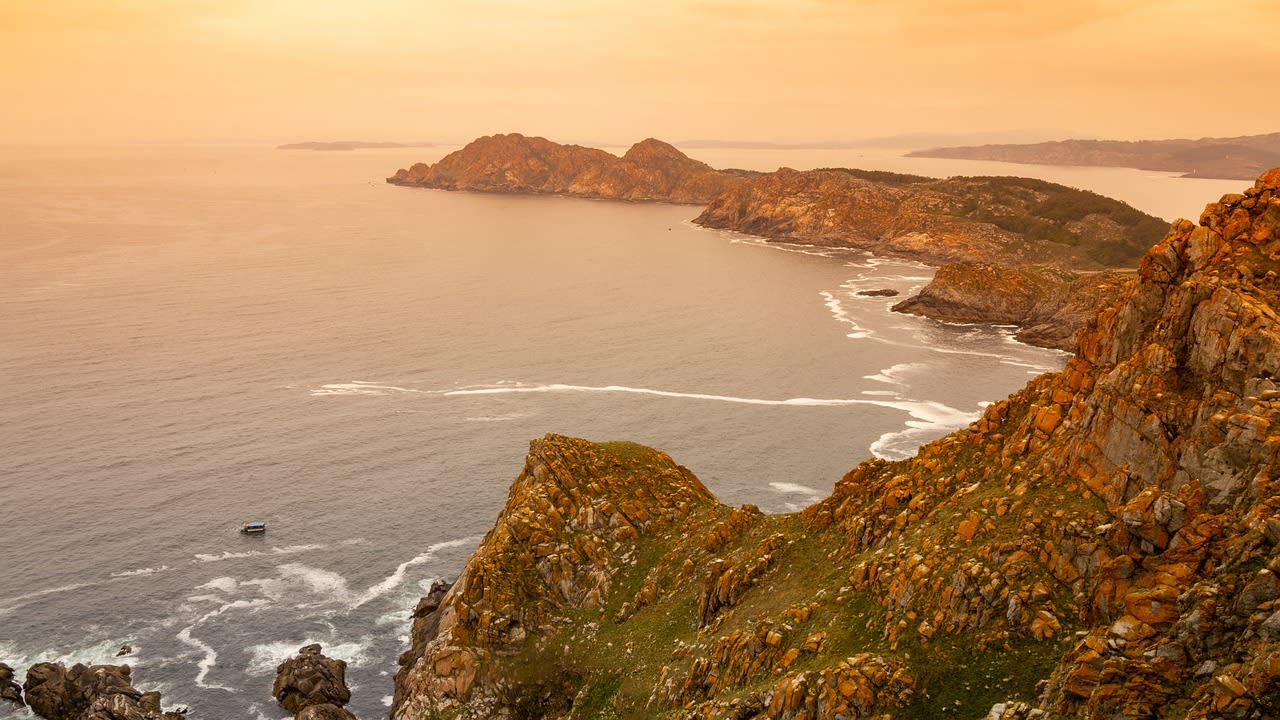
- Ruta del Faro Cliff Walk: The Ruta del Faro is a 4 km loop trail across Faro island from the ferry landing — climbing through pine forest to the island lighthouse (165 m), traversing the outer Atlantic cliff edge with views of sea stacks and nesting seabird colonies, and returning via the lagoon shore. The highest point delivers a 360° panorama of the Rías Baixas, the open Atlantic, and the ría. The cliff edge walk in May is particularly rewarding when yellow-legged gull nesting activity is at its peak and wild flowers cover the cliff-top grassland.
- Kayaking and Snorkelling: Sea kayak hire is available from operators at the ferry landing, allowing exploration of the sea caves and cliff base of the outer islands and access to the channel between Faro and San Martiño where marine life is most concentrated. The rock platforms below the lighthouse on Faro island's western face, accessible at low tide on a short scramble, provide direct snorkelling access to the most exposed Atlantic reef habitat without a boat.
- Wildlife Watching: The Cíes are one of the finest seabird watching locations in mainland Spain — the cliffs of the outer coast host European shag, great cormorant, peregrine falcon, and the large yellow-legged gull colony. Bottlenose dolphins are regularly sighted in the channels between the islands from the ferry crossing and from cliff viewpoints in mornings. The Audouin's gull — a rarer Mediterranean species at the northern limit of its range — is occasionally recorded in the ría mouth area.
💡 Travel Tips
Best Season: June is the sweet spot — seabirds breeding, water warming, crowds below July–August peak, and permits more easily obtained. Late May and September are alternatives. July–August is peak demand — permits sell out within minutes of opening (usually in April–May for summer dates). October is quieter and still mild; the islands have a melancholy Atlantic beauty in autumn.
Campsite: The park campsite on Faro island (200 pitches) is the only overnight option — book separately through the national park system. Camping outside the designated area is prohibited. Day trippers must return on the last ferry (times vary; check schedule carefully — missing the last ferry means camping without a booking). Bring food and water: the single island restaurant has limited capacity and the supply chain is entirely ferry-dependent.
🌱 Conservation
The main ongoing conservation challenge is the invasive tree species (maritime pine and eucalyptus) that were planted in the mid-20th century and have displaced the native oak and scrubland vegetation. A long-term programme to restore native Atlantic oak forest (Quercus robur and Q. pyrenaica) is progressively replacing exotic plantations across both islands — the process is slow (decades) but already visible in the eastern slopes of Faro island where pine clearance has allowed native heath regeneration. Invasive plant species — particularly Carpobrotus edulis (ice plant) — are also actively managed on the cliff-top grasslands that provide nesting habitat for shorebirds. Climate change effects on the posidonia seagrass beds (vulnerable to warming sea temperatures) are monitored through annual underwater surveys.