Nanga Parbat
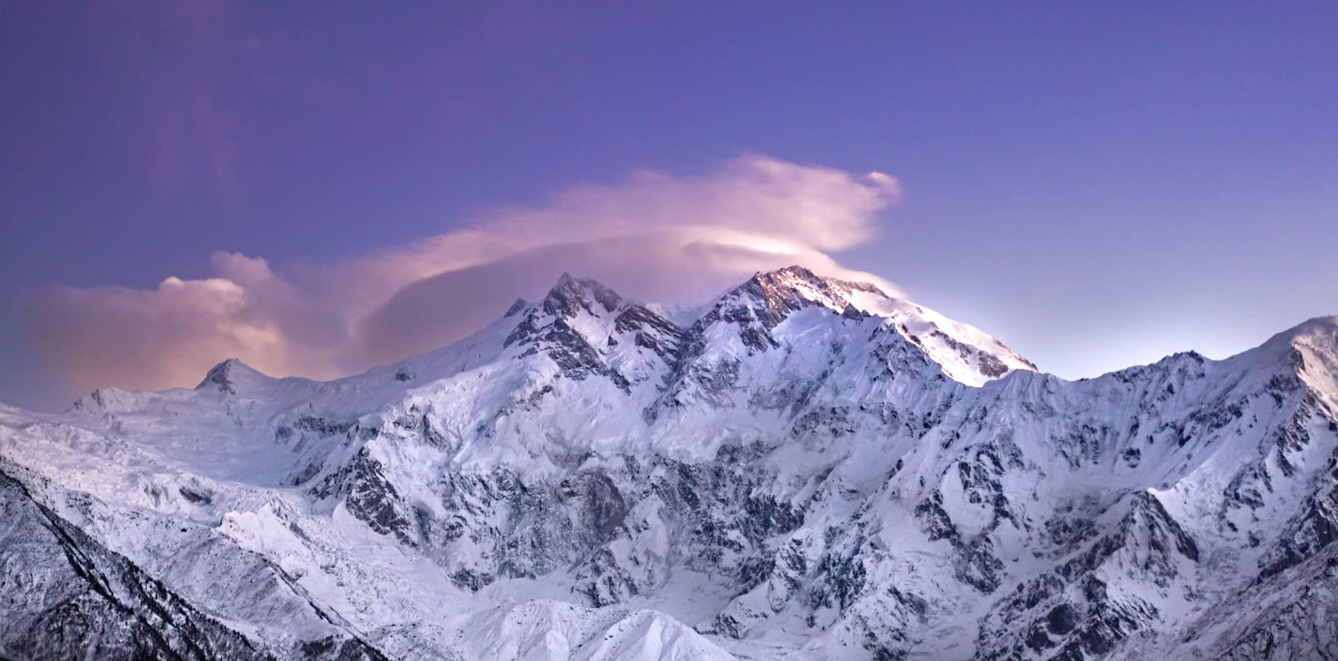
Nanga Parbat — the 'Naked Mountain' in Urdu — is the ninth-highest mountain on Earth at 8,126 m and one of the most formidable and psychologically imposing peaks in the world. Its three faces are each extraordinary: the Rupal Face is the world's highest mountain wall, rising 4,600 m from the valley floor in a single sweep; the Diamir Face was the route of the first ascent; and the Rakhiot Face overlooks the Fairy Meadows, one of Pakistan's most beloved destinations. The mountain has claimed over 60 climbers' lives and is regarded by mountaineers as one of the most technically and psychologically demanding 8,000 m peaks.
🌍 Geography and Ecosystem
Nanga Parbat stands in dramatic isolation at the western anchor of the Himalayan range, where the Indus River makes a massive bend around its base:
- Rupal Face: At 4,600 m vertical rise, the Rupal Face is the highest mountain face on Earth — a wall of ice, rock, and glacier that dominates the Rupal Valley with an almost incomprehensible scale.
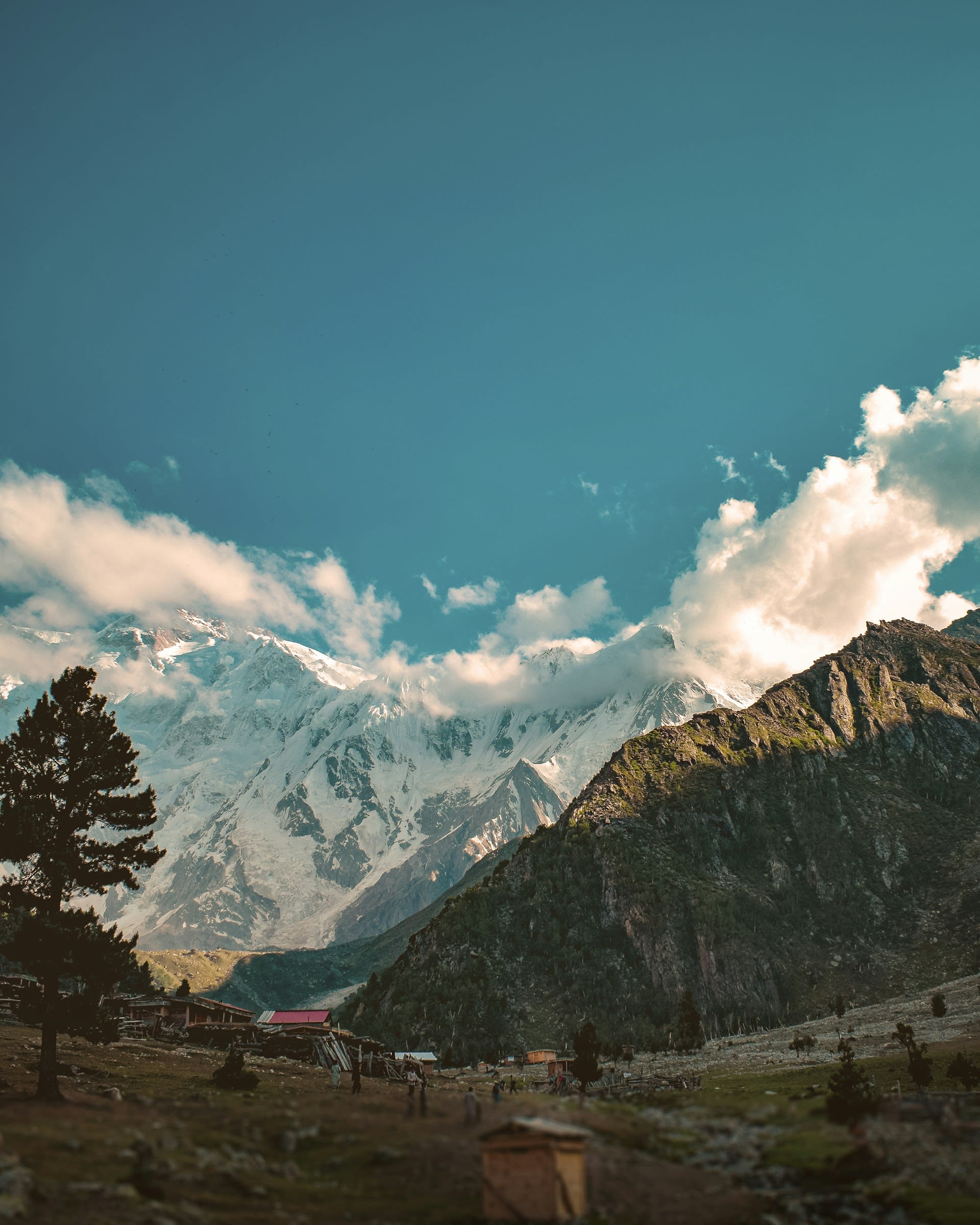
- Fairy Meadows (Nanga Parbat Base Camp): The grassy alpine plateau of Fairy Meadows (3,300 m) on the Rakhiot side provides one of the world's most extraordinary viewpoints, with Nanga Parbat filling the northern horizon.
- Toshain and Rupal Valleys: The valleys surrounding the massif support extraordinary biodiversity — markhor (the world's largest wild goat), snow leopard, brown bear, and golden eagle — in a landscape of exceptional scenery.
- Glaciers: The Rakhiot, Diamir, and Rupal glaciers are among the largest in the Pakistani Himalaya, feeding the Indus and its tributaries.
📜 History and Cultural Significance
Nanga Parbat's mountaineering history is among the most dramatic and tragic in the annals of the sport. The mountain claimed its first victims in 1895 when Albert Mummery — one of the greatest alpinists of the 19th century — disappeared on the Diamir Face. The 1934 and 1937 German expeditions suffered catastrophic avalanche disasters, losing 16 men between them. The mountain was known as the 'German mountain' due to the obsessive national focus on its ascent during the Nazi era. Hermann Buhl finally reached the summit on 3 July 1953 — alone, without oxygen, and only hours before his permit expired — in what remains one of the most extraordinary acts of individual mountaineering achievement in history. The surrounding valleys are inhabited by Shin, Kohistani, and other communities who have lived in the mountain's shadow for millennia.
🏃 Activities and Attractions
Nanga Parbat offers extraordinary trekking and mountaineering opportunities:
- Fairy Meadows Trek: A 3–4 hour jeep track followed by a 2–3 hour hike from the Rakhiot bridge leads to the famous Fairy Meadows, one of Pakistan's most rewarding and relatively accessible alpine destinations.
- Nanga Parbat Base Camp: A further 2–3 hour hike from Fairy Meadows leads to the Rakhiot base camp at 3,962 m, with up-close views of the Rakhiot Face and Rakhiot Glacier.
- Rupal Valley Trek: The approach to the Rupal Face requires a multi-day trek but rewards with views of the most dramatic mountain wall on Earth.
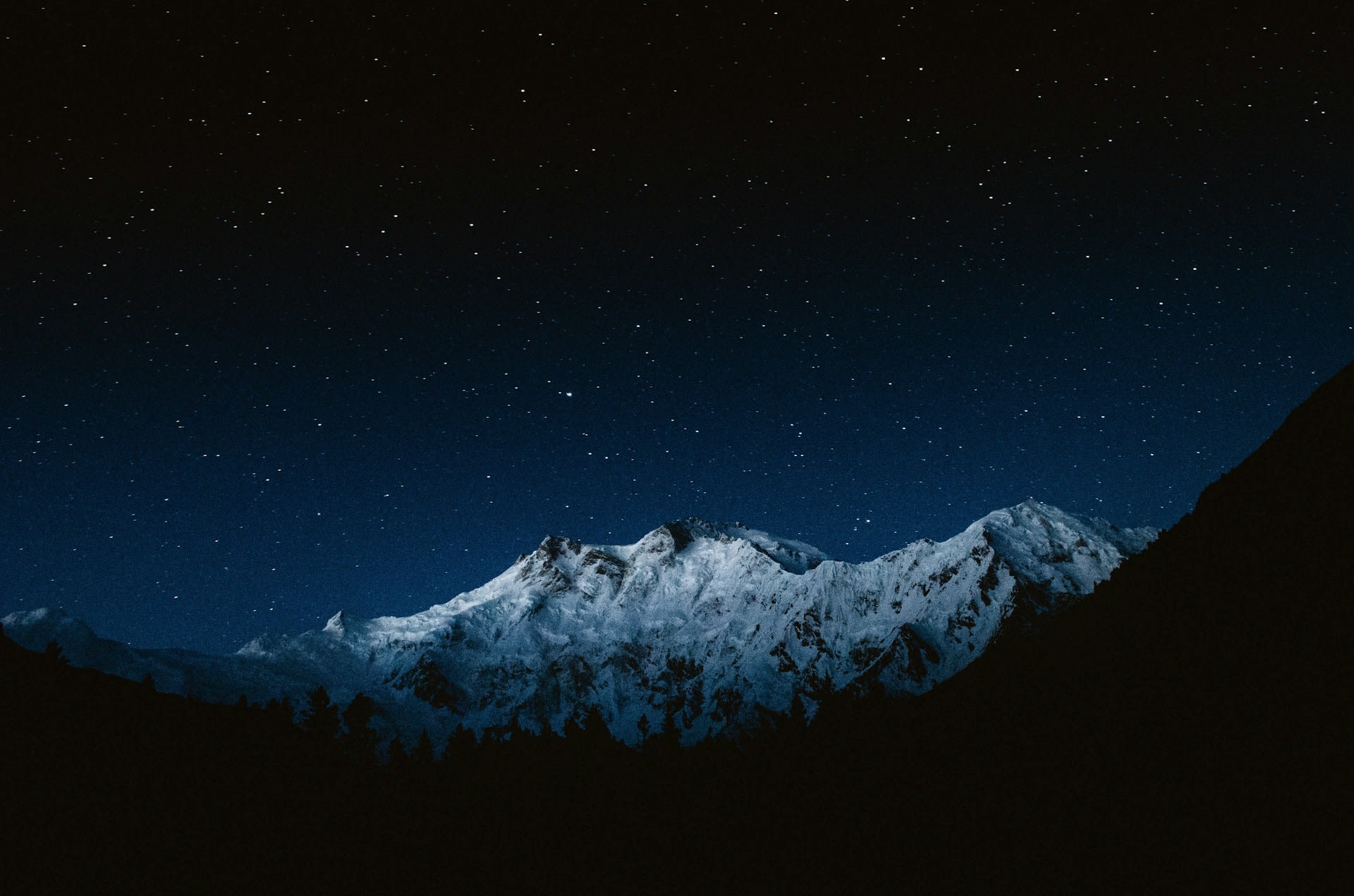
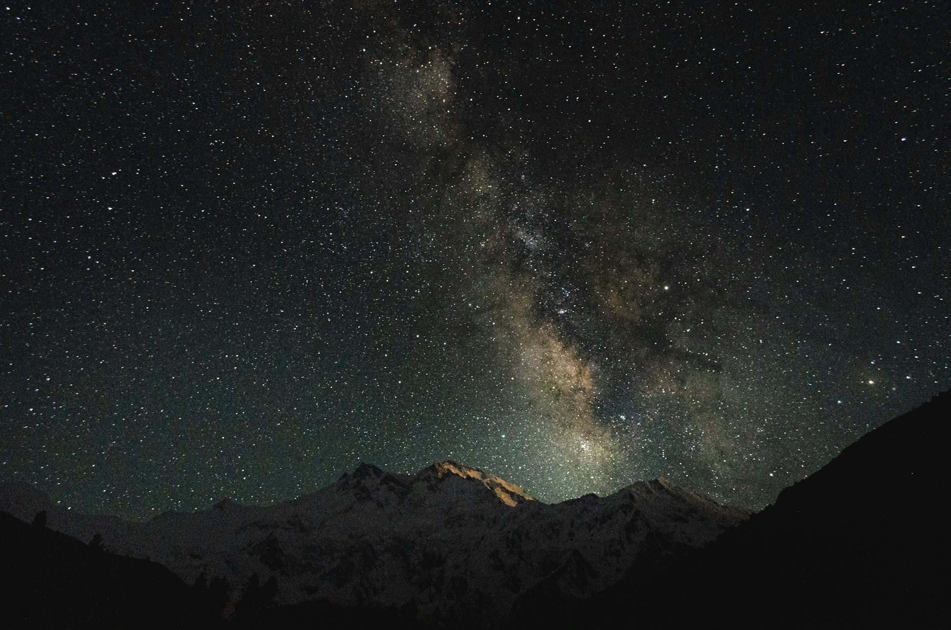
- Stargazing: Fairy Meadows is celebrated as one of the best dark sky locations in Pakistan, with the mountain summit and the Milky Way overhead combining for extraordinary night photography.
💡 Travel Tips
How to Get There: Drive or take a bus from Gilgit along the Karakoram Highway to the Rakhiot Bridge (2–3 hours). From there, a jeep track (4WD required) leads to Tato Village, followed by the hike to Fairy Meadows. Coordinates: 35.24° N, 74.59° E.
Best Time to Visit: May–September for accessible conditions. The most stable weather is typically July–August. Snow can fall at any time at these altitudes.
What to Bring: Full camping equipment if staying at Fairy Meadows, warm sleeping bag (temperatures drop below freezing at night even in summer), head torch for night walks, and trekking poles for the rocky trail from Tato.
Accommodation: Basic wooden huts and camping spots are available at Fairy Meadows, operated by local families. Chilas, on the KKH, is the nearest town with standard hotel accommodation.
🌱 Conservation
The Nanga Parbat area lacks formal national park protection. The Fairy Meadows are managed informally by local communities and the Forest Department. The dramatic increase in trekking tourism in recent years has brought littering, trail erosion, and firewood depletion to the Fairy Meadows area. Conservation advocates have called for the establishment of a formal protected area encompassing the Nanga Parbat massif to manage tourism, protect wildlife habitat, and preserve the extraordinary natural character of one of Pakistan's greatest landscapes.
✨ Conclusion
Nanga Parbat is the mountain that defines the western end of the Himalayas — a peak of such raw scale and dramatic history that it occupies a unique place in the imagination of mountaineers and travellers alike. Whether encountered from the blissful grass of Fairy Meadows or contemplated from the valley road below, it is a mountain that changes those who see it. Pakistan's 'Naked Mountain' reveals everything.