North Cape
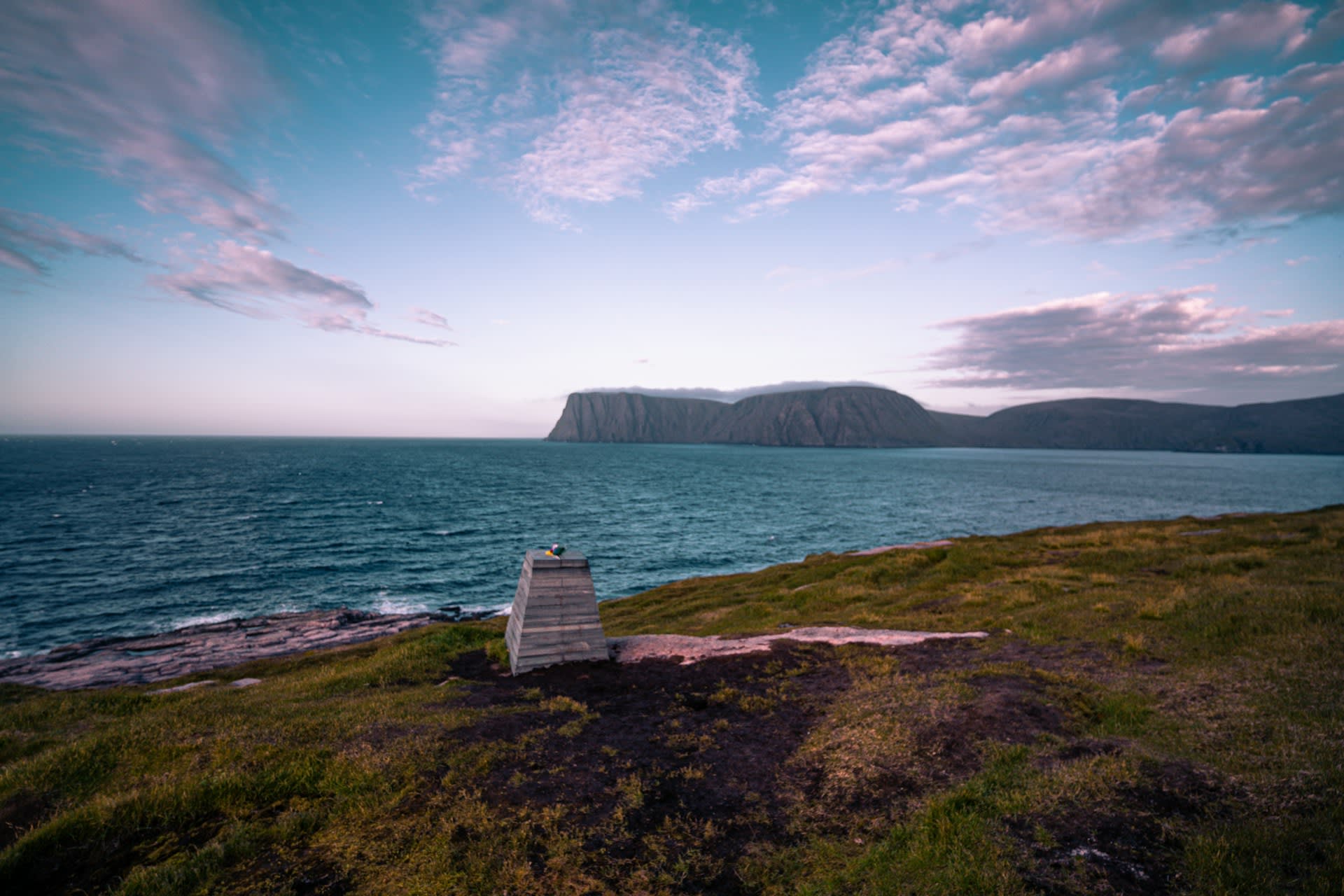
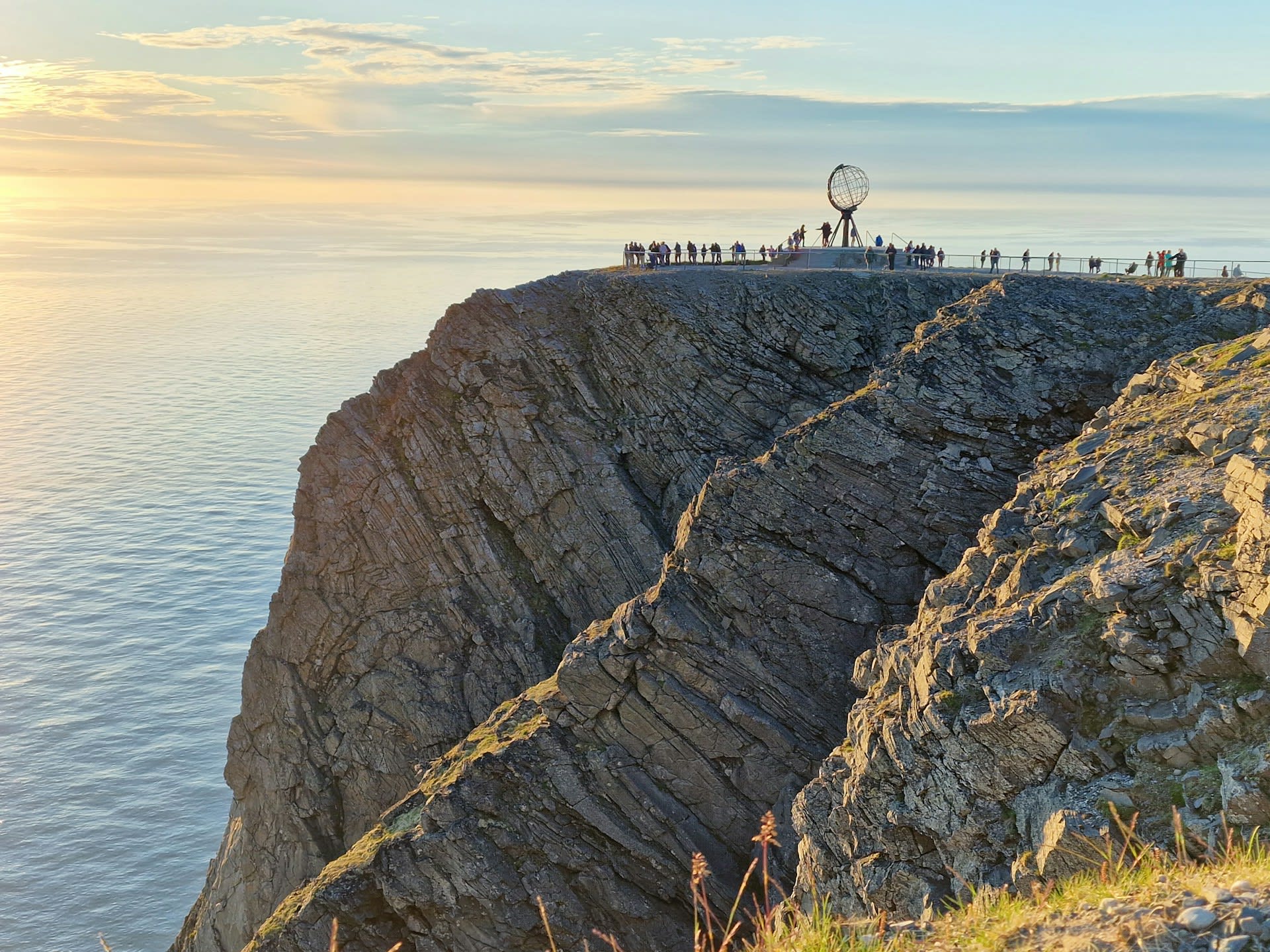
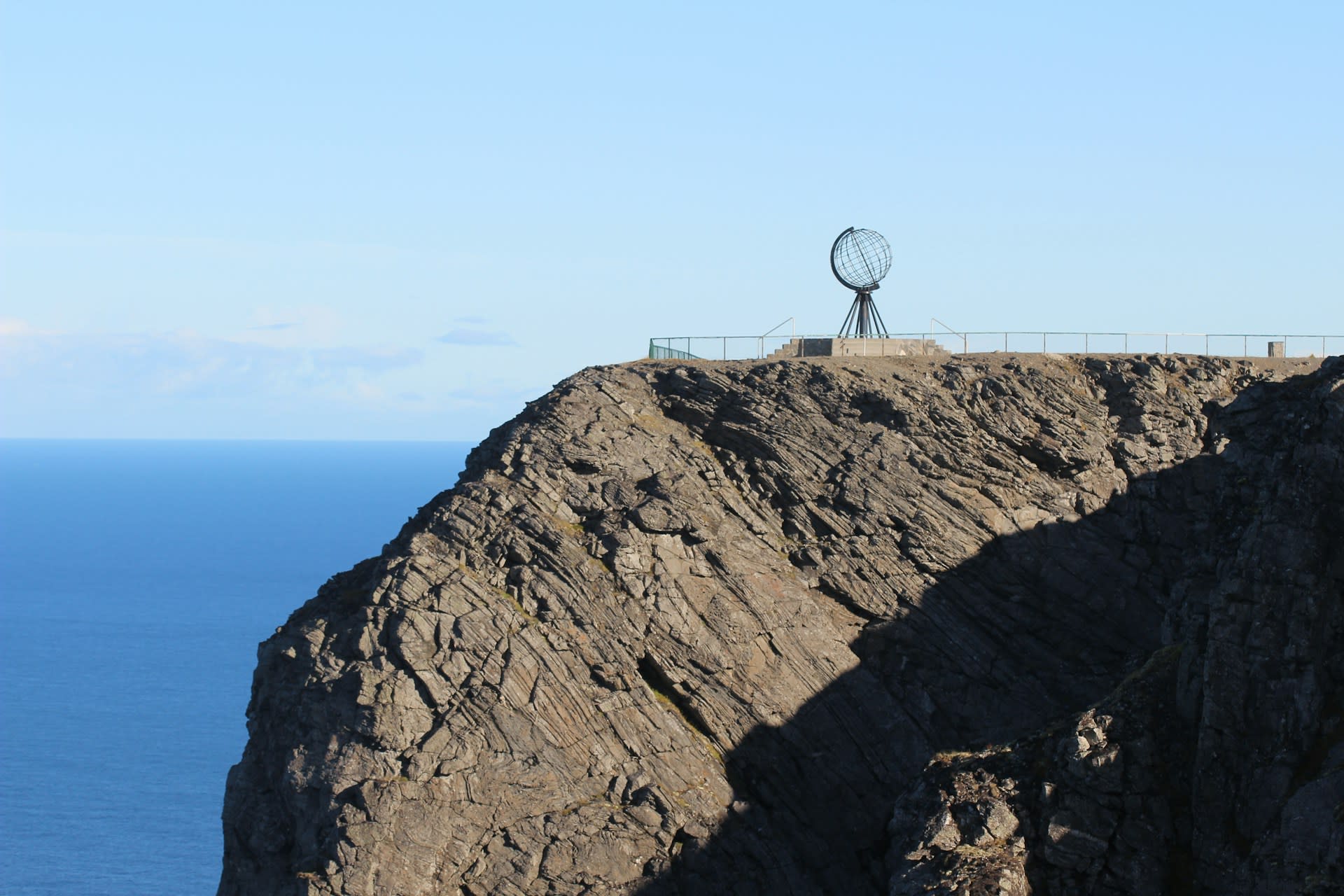
North Cape (Norwegian: Nordkapp) stands at 71°10'21"N on the island of Magerøya, Finnmark county, and is celebrated worldwide as the northernmost point of mainland Europe accessible by road — a claim that is geographically approximate (the true northernmost point is the uninhabited Knivskjelodden promontory, 1.5 km further north, accessible only on foot) but culturally absolute. The defining feature is a sheer basalt cliff face plunging 307 metres straight down to the Barents Sea, topped by a flat plateau from which the globe sculpture — erected in 1978 and now the symbol of the cape — overlooks the Arctic Ocean. From here, the North Pole lies 2,102 kilometres due north, with no land in between. The midnight sun is visible without interruption from 14 May to 29 July each year; conversely, polar night — total darkness — lasts from 18 November to 24 January, making North Cape a destination of extreme seasonal contrast.
🌍 Geography and Ecosystem
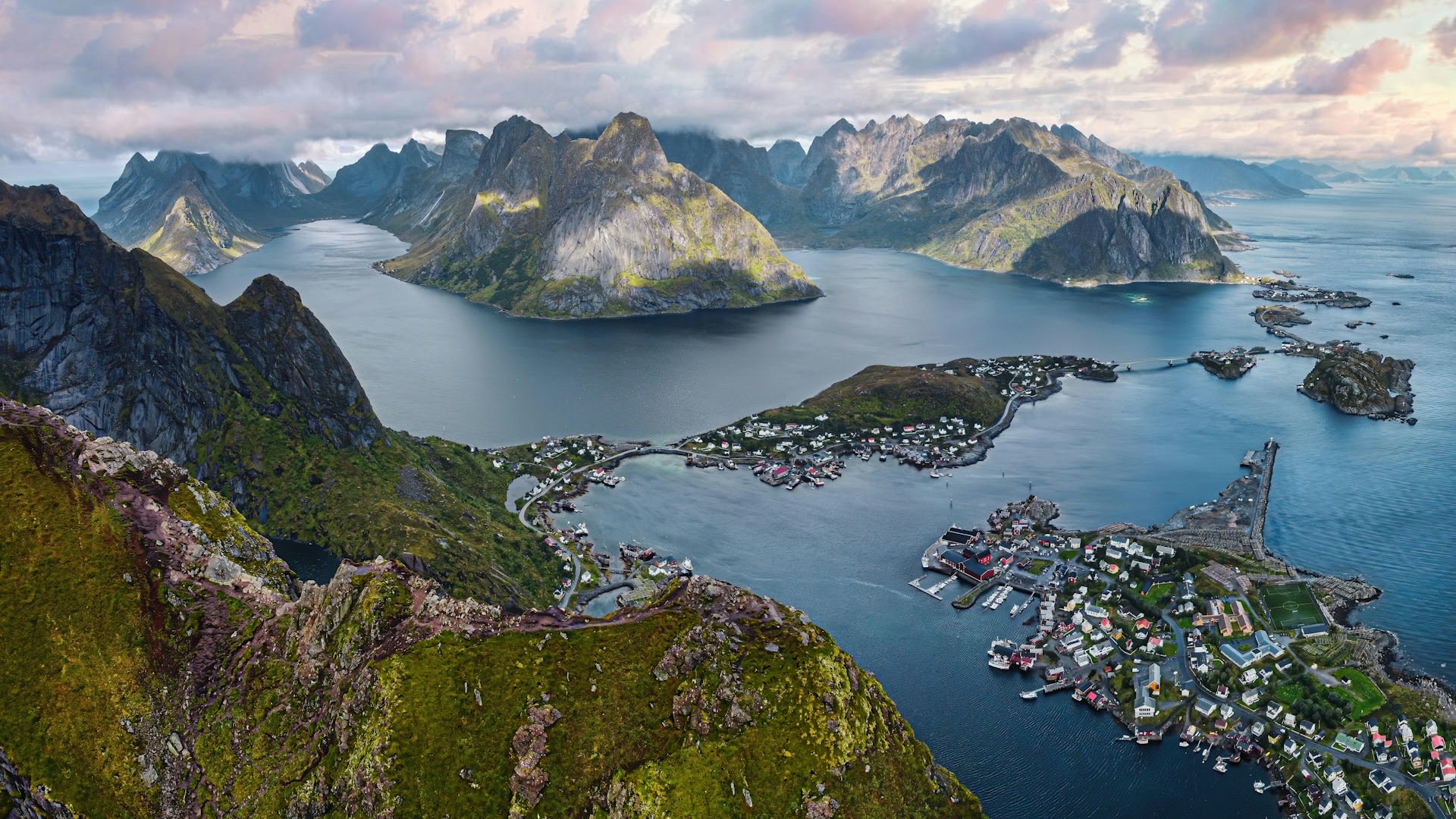
- The North Cape Plateau: A 260-hectare flat-topped basalt plateau at 307 metres elevation, forming the theatrical stage of the tourist experience. Winds regularly exceed 30 m/s on the plateau and snow can fall in any month of the year. The bare, windswept character gives an impression of standing at the absolute edge of the habitable world.
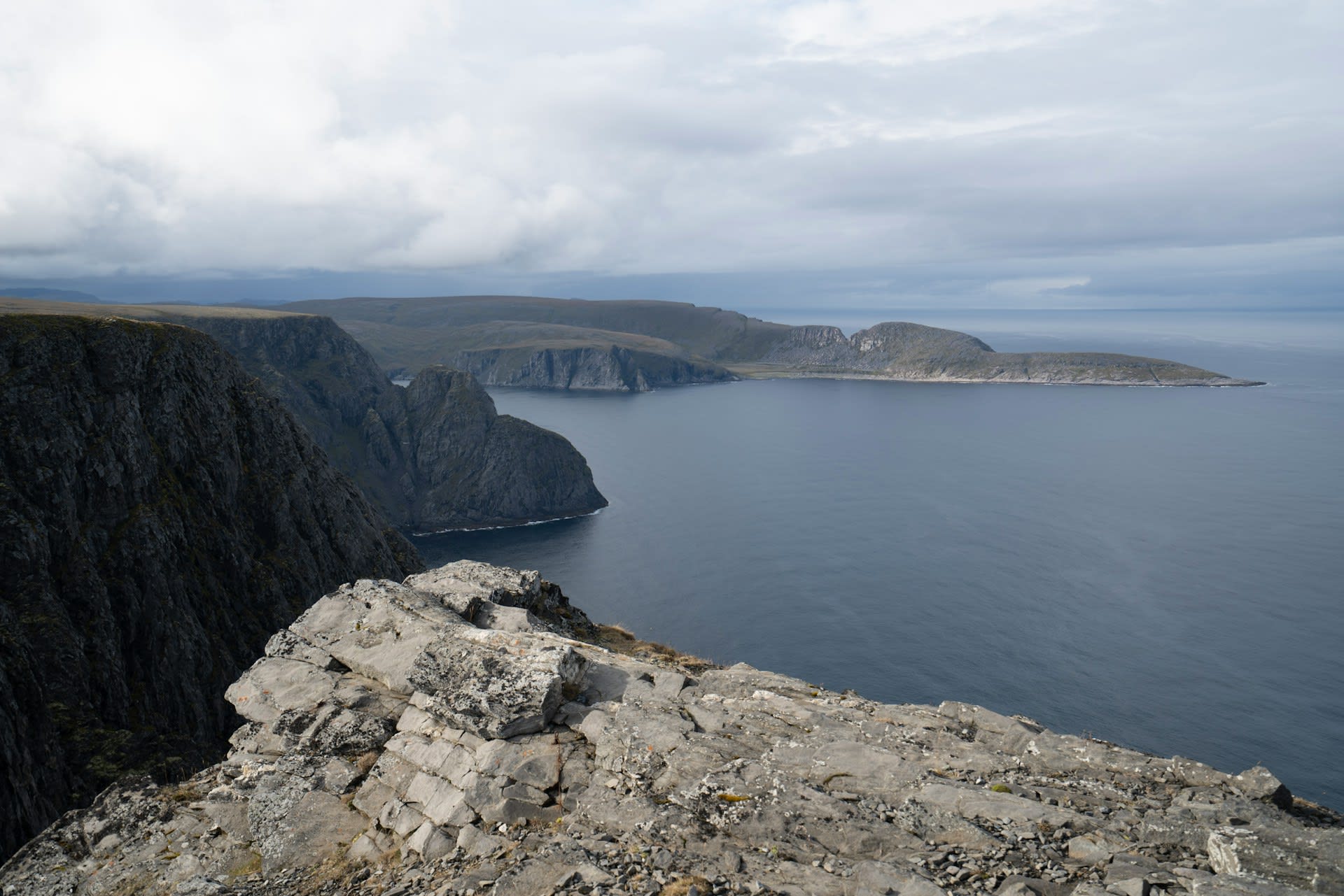
- Knivskjelodden Promontory: The actual northernmost point of Europe at 71°11'08"N, a 9-km return hiking trail from the North Cape car park across open tundra. The path is unmarked but waymarked with cairns and takes 3–5 hours. Reaching Knivskjelodden provides bragging rights over the formal North Cape monument — and a certificate from the platform there.
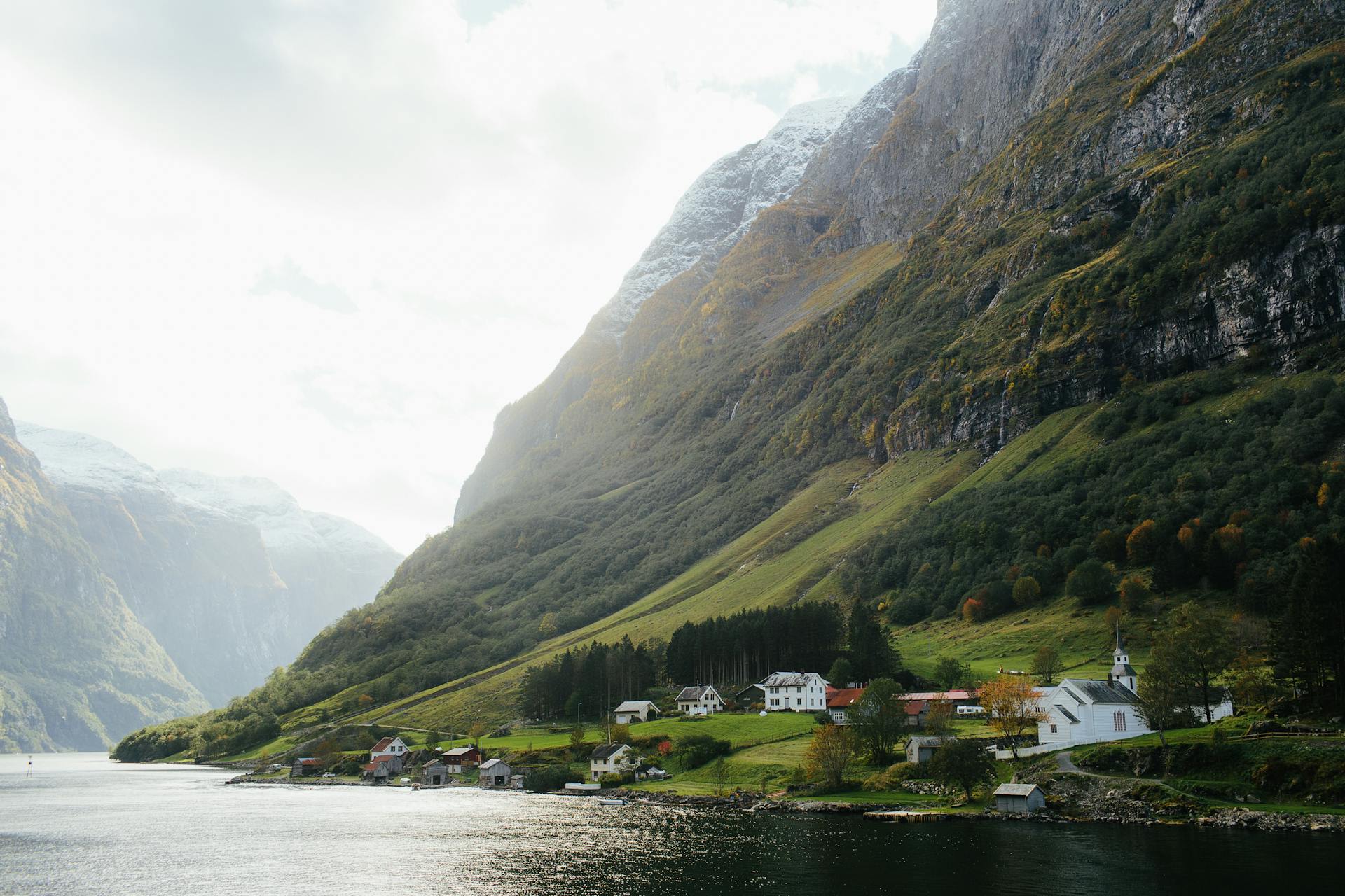
- Skarsvåg Fishing Village: The world's northernmost fishing village (71°07'N), 10 km from North Cape, with a population of approximately 60. Traditional wooden fishing boats still operate from here during the king crab season (October–April), and the village offers an unmediated glimpse of Arctic fishing life far removed from the tourist complex at the cape.
- Barents Sea Birdlife: The cliff faces below the plateau host several thousand pairs of kittiwake, razorbill, and northern fulmar, with the peak nesting season from May to August coinciding with the midnight sun. The convergence of Atlantic and Arctic water masses creates feeding conditions that make the Barents Sea one of the most important seabird feeding zones in the northern hemisphere.
📜 History and Cultural Significance
The Sámi people — specifically the Sea Sámi and the Reindeer Sámi — have inhabited Magerøya and the surrounding Finnmark plateau for at least 10,000 years, following reindeer migration routes that cross the island's central tundra. Their relationship with the cape was spiritual rather than navigational, and several rock formations in the area carry Sámi sacred significance. King Oscar II of Sweden-Norway visited North Cape in 1873, beginning a tradition of royal pilgrimage that has drawn monarchs and heads of state from across Europe, including King Chulalongkorn of Thailand (1907) and Prince Eugen of Sweden (numerous visits). The commercial tourism operation began in earnest with the opening of the Nordkapp Hall visitor centre in 1988, built largely inside the cliff and featuring an auditorium, restaurant, and a 180-degree panoramic cinema screen showing the cape across all four seasons.
🏃 Activities and Attractions
- Midnight Sun Viewing: Standing on the plateau between 14 May and 29 July and watching the sun maintain a constant position above the horizon — dipping only slightly at solar midnight before rising again — is the defining North Cape experience. The Nordkapp Hall stays open through the night during this period and arranges champagne celebrations at solar midnight for arriving tour groups.
- Hiking Knivskjelodden: The 9-km tundra trail to the true northernmost point of Europe is the most rewarding independent activity on Magerøya. The route crosses open fell with no trees, no shelter, and full exposure to Arctic weather — making proper waterproofing and navigation equipment essential. Completion is marked with a certificate signed at the small platform on the promontory.
- King Crab Safari: The introduced Russian king crab (Paralithodes camtschaticus) has colonised the Barents Sea coast and now supports a substantial local fishery. Boat tours from Skarsvåg, Nordvågen, and Honningsvåg take visitors to pull pots and cook freshly caught crab on board — an increasingly popular winter activity.
- Northern Lights Photography: November to February, when polar night creates a backdrop of absolute darkness, is prime aurora season. The flat plateau and unobstructed 360° sky make North Cape one of the finest aurora viewing locations in mainland Norway, and several local operators offer guided photography nights with heated bases.
- Nordkapp Hall Visitor Centre: The cave-like interior of the cliff houses a cinema presenting a 40-minute film about North Cape through all four seasons, a chapel where couples can be married at the world's northernmost wedding venue, several restaurants, and a dedicated children's section called 'Children of the Earth'.
💡 Travel Tips
Best Season: Midnight sun visitors: mid-May to late July. Aurora and polar night: late November to late January. Summer brings the risk of fog obscuring the horizon; winter brings extreme cold (down to –20°C) and wind. Late April offers a compromise of long evenings, spring snow, and low visitor numbers.
What to Pack: Thermal base layers, windproof outer shell, waterproof over-trousers, and sturdy footwear are non-negotiable year-round. Even in July the plateau temperature can be 5°C with a 20 m/s wind. Winter visitors should carry hand warmers, balaclava, and crampons for icy paths.
Accommodation: Honningsvåg (population 2,500) is the service hub with hotels, restaurants, and a supermarket. North Cape Camping (open May–September) offers the most dramatic position, situated on the island with sea views. Book hotel accommodation at least 3 months in advance for the summer solstice period.
🌱 Conservation
The Sámi reindeer herding that has shaped the Magerøya landscape for millennia faces two interrelated threats: the expansion of tourist infrastructure into traditional grazing areas, and the increasing incidence of freeze-thaw icing events ('rain-on-snow') driven by climate change, which lock the lichen pasture under impenetrable ice layers and cause mass starvation of reindeer herds. Norwegian reindeer herding legislation provides some protection for traditional grazing rights, but the practical balance between tourism revenue and Sámi livelihoods remains contested. The invasive king crab, while economically valuable, has disrupted benthic ecosystems along the Finnmark coast by consuming the bottom-dwelling organisms — urchins, worms, shellfish — that form the base of the marine food web.