Hardangerfjord
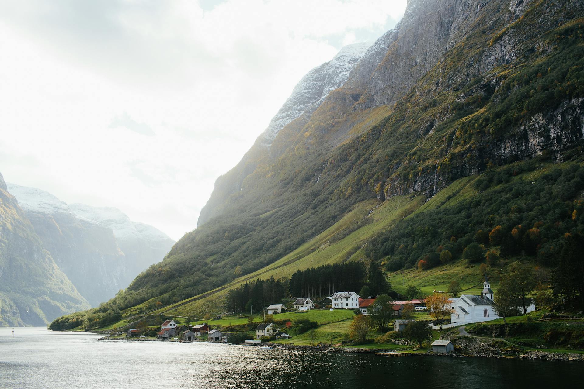
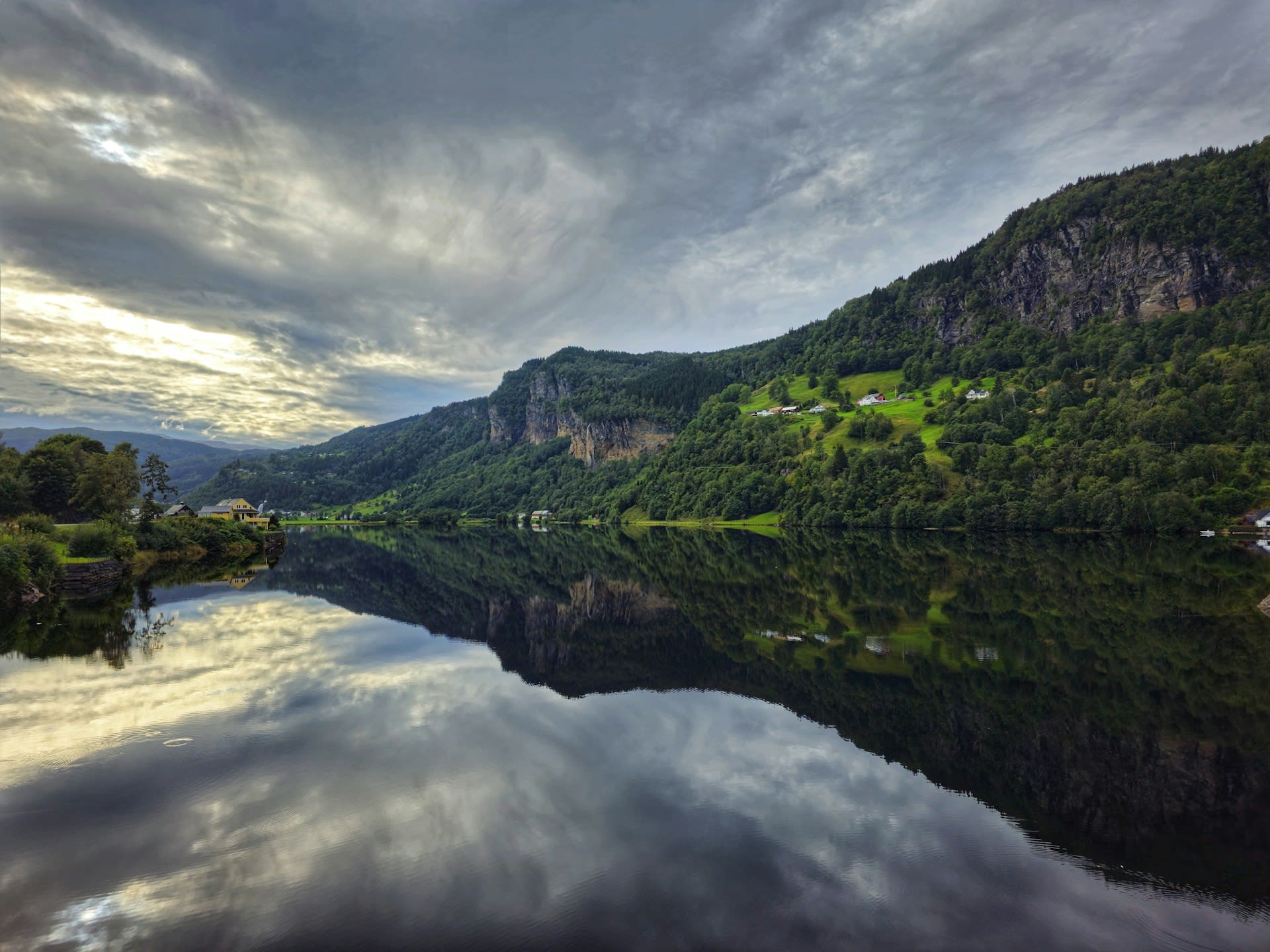
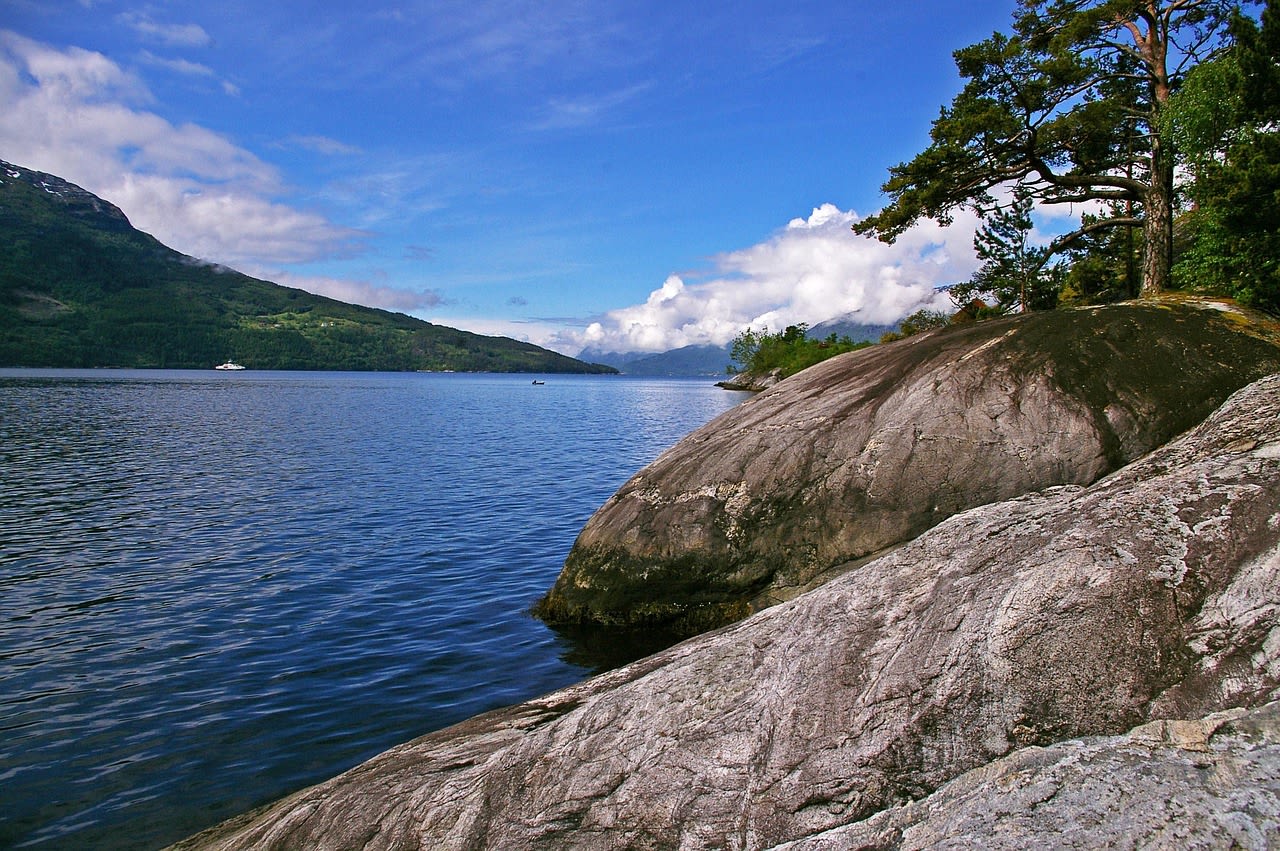
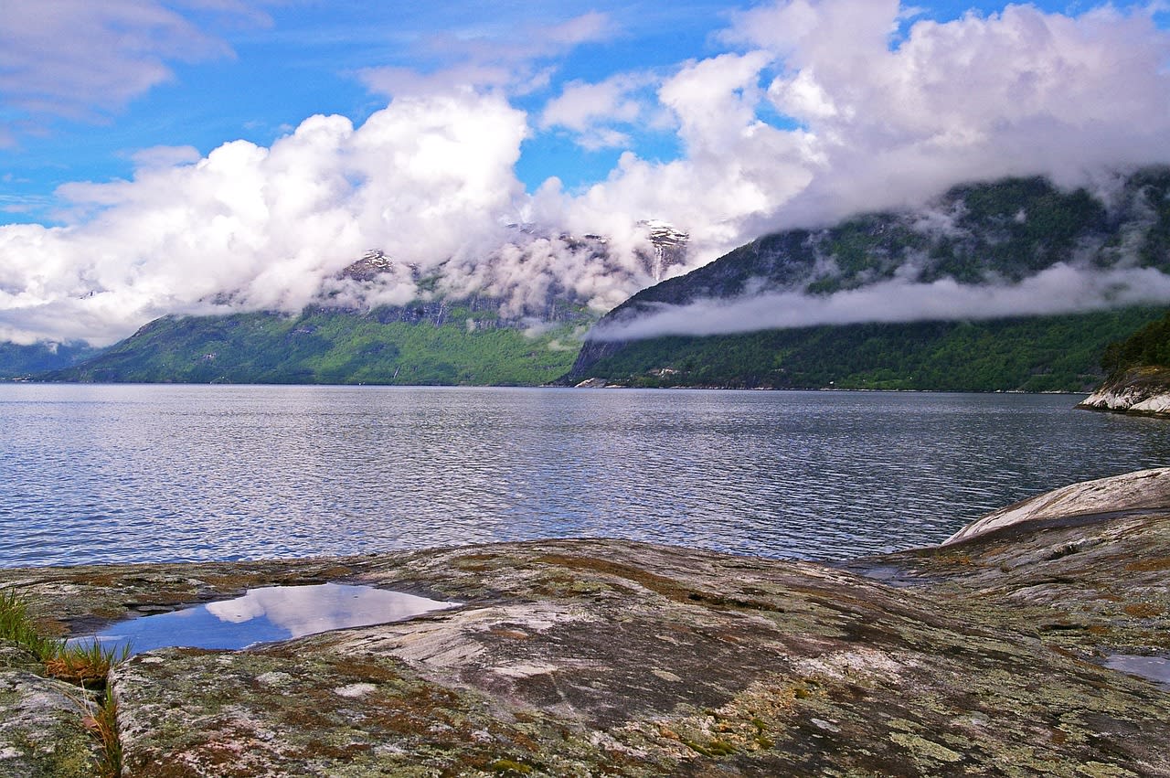
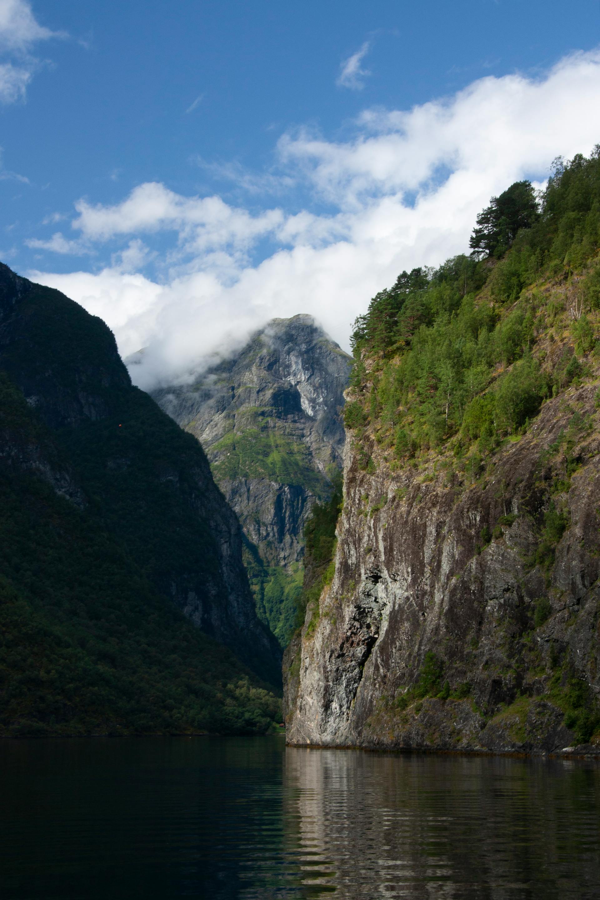
Hardangerfjord is Norway's second longest fjord at 179 km — a deep glacially carved trough in Vestland county (Hordaland), running east from the coast near Bergen into the interior mountain region around Odda. The fjord is celebrated for its exceptional combination of natural beauty and cultural landscape: the Hardanger orchard district (Sørfjorden arm and the villages of Ullensvang, Lofthus, and Aga) is Norway's most important fruit-growing region, producing approximately 40% of Norwegian apples and cherries on terraced orchards above the fjord edge. In May — when the apple and cherry trees bloom simultaneously — the fjord shore transforms into one of Europe's most spectacular and least-publicised spring flower landscapes: miles of white and pale-pink blossom above the blue fjord, with the Folgefonna glacier (the third largest in mainland Norway) providing a snow-white backdrop above. The fjord is also the gateway to Hardangervidda — Norway's largest national park and Europe's largest high-mountain plateau — and to iconic viewpoints including Trolltunga (the rock formation jutting 700 m above Ringedalsvatnet), Vøringsfossen (one of Norway's most famous waterfalls, 182 m drop), and the Hardangerbridge — the world's longest suspension bridge over water at time of completion.
🌍 Geography and Ecosystem
- Hardanger Orchard District: The south-facing slopes above the Sørfjorden (Hardangerfjord's southernmost arm) between Ullensvang and Utne are covered by approximately 3 million fruit trees — apple, cherry, plum, and pear — terraced on the steep gneiss slopes above the water. The blooming season (typically first two weeks of May) transforms the fjord into a landscape of extraordinary pastoral beauty: white and pale-pink blossoms from water level to the snowfield above, the smell of fruit flowers in the fjord breeze, and the clarity of spring air following the last winter storms. The Hardanger cideries and apple farms — Hardanger Sider and several farm-based producers — welcome visitors during harvest (August–September) for apple picking and cider tasting.
- Trolltunga: Trolltunga (Troll's Tongue) is a horizontal rock shelf projecting 700 m above Ringedalsvatnet lake — formed by glacial erosion and freeze-thaw fracturing of the local gneiss. The hike to Trolltunga (27 km round trip, 800 m ascent, 8–12 hours) from Tyssedal is one of Norway's most demanding and most photographed day hikes — the queue for the summit rock photograph in July–August can exceed two hours. The view from the rock — with the lake below, the Hardanger mountains behind, and the void between your feet and the water 700 m below — is elemental. Book a guide for the hike in snow conditions (October–June when the trail crosses snowfields requiring route-finding skills).
- Vøringsfossen: Vøringsfossen — a 182 m waterfall dropping from the Hardangervidda plateau edge into the deep Måbødalen canyon — is one of Norway's most visited natural sites. The waterfall is accessible from the E134 highway above (10 min walk to the canyon edge viewpoint) or by the steep Måbødalen gorge path from the valley floor below (3 km, 400 m ascent). The full 182 m drop is visible from neither the top nor the bottom — the finest view is from a new observation platform built on the canyon wall midway, accessible by path from the new National Tourist Route visitor centre at Fossli.
- Hardangervidda National Park: The Hardangervidda plateau (3,422 km²) above the fjord is Europe's largest mountain plateau — a treeless, lake-studded high moorland at 1,200–1,400 m, supporting Norway's largest reindeer herd (approximately 10,000–20,000 wild reindeer), golden eagle, and the characteristic sub-arctic moorland ecosystem. The Hardangervidda is crossed by the historic Oslo–Bergen railway (the world's highest railway mainline at 1,222 m) and provides extensive hiking across a landscape that changes from winter conditions through July. The plateau is the training ground and scene of some of Norway's most iconic ski touring routes in March–April.
📜 History and Cultural Significance
Hardangerfjord was central to the emergence of Norwegian Romantic nationalism in the 19th century — the composer Edvard Grieg (who lived at Troldhaugen near Bergen and is buried in the Hardanger area) drew extensively on Hardanger folk music traditions, particularly the Hardingfele (Hardanger fiddle) — a distinctive Norwegian fiddle with sympathetic resonating strings, developed in the Hardanger district and fundamental to Norwegian folk and classical music. The Hardanger fiddle remains the national instrument of Norway and is still made by craftsmen in the Hardanger villages.
🏃 Activities and Attractions
- Spring Orchard Walk (May): A self-guided orchard walk along the Nå-Lofthus blossom trail (marked path, 5 km, flat terrain) through the orchards above Lofthus village in the first two weeks of May is the finest spring experience in the Hardanger district. The combination of white blossom, blue fjord, and snow-capped Folgefonna glacier above makes this the classic Norwegian spring photograph. The same trail passes the historic Lofthus farm buildings and the 12th-century Ullensvang church.
- Trolltunga Hike: The full-day Trolltunga hike (8–12 hours from Tyssedal) is the most demanding and most rewarding day hike in the Hardanger area. July–September offers the best conditions (snow-free trail) — guided hikes are available from several Odda operators who provide safety guidance, navigation, and emergency support on the extended high plateau section. The new car park and shuttle bus system (mandatory in July–August to control vehicle numbers at the trailhead) requires pre-booking.
- Folgefonna Glacier Walk: The Folgefonna glacier (third largest in mainland Norway at 212 km²) is accessible via glacier walks from Juklavasshytta on the eastern side — guided ice walks on the glacier surface are offered in summer (June–September), providing the tactile experience of Norwegian glacier ice in a setting where the fjord is visible far below. The glacier has its own national park designation (Folgefonna National Park) and is the only glacier in mainland Norway that calves directly into a fjord at its western margins.
- Hardangerfjord Ferry and Kayak: The public ferry network on the fjord (connecting Utne, Kvanndal, and Bruura) allows a fjord circuit by ferry combined with cycling on the fjordside roads — a popular day loop from Bergen. Sea kayaking on the Sørfjorden arm (sheltered from wind by the mountain walls) is excellent in calm conditions — rental and guided tours available from Utne and Lofthus. The combination of glassy fjord water, orchard slopes above, and Folgefonna glacier visible at the head of the fjord makes Sørfjorden one of Norway's finest inland sea kayaking routes.
💡 Travel Tips
Best Season: May for orchard blooms (check visithardangerfjord.com for bloom dates — varies by up to 2 weeks annually depending on spring temperatures). July–August for Trolltunga and summer hiking (full daylight, snow-free trails). September–October for autumn colour on the fjord slopes and cider harvest at the Hardanger farms. November–March: the fjord in winter has dramatic light and is largely visitor-free — the Hardangervidda cross-country skiing season begins January on the plateau.
Apple Cider Tasting: The Hardanger cider trail (Hardanger siderevegen) connects farm cideries along the Sørfjorden — several farms offer tastings and sales direct from the producer. The most accessible are at Lofthus and Ullensvang villages.
🌱 Conservation
The Trolltunga rock and its approach trail have been severely tested by the growth of visitor numbers — from a few hundred per year in the 2000s to over 80,000 annual visitors in 2019. The mandatory shuttle bus, timed entry permits for the final section, and compulsory guide booking in snow conditions (implemented 2016–2019) were responses to deaths (two in the winter of 2014–2015 from exposure and navigation failures) and severe trail erosion. The current management system has significantly improved safety and vegetation recovery along the most eroded trail sections.