Vatnajökull National Park
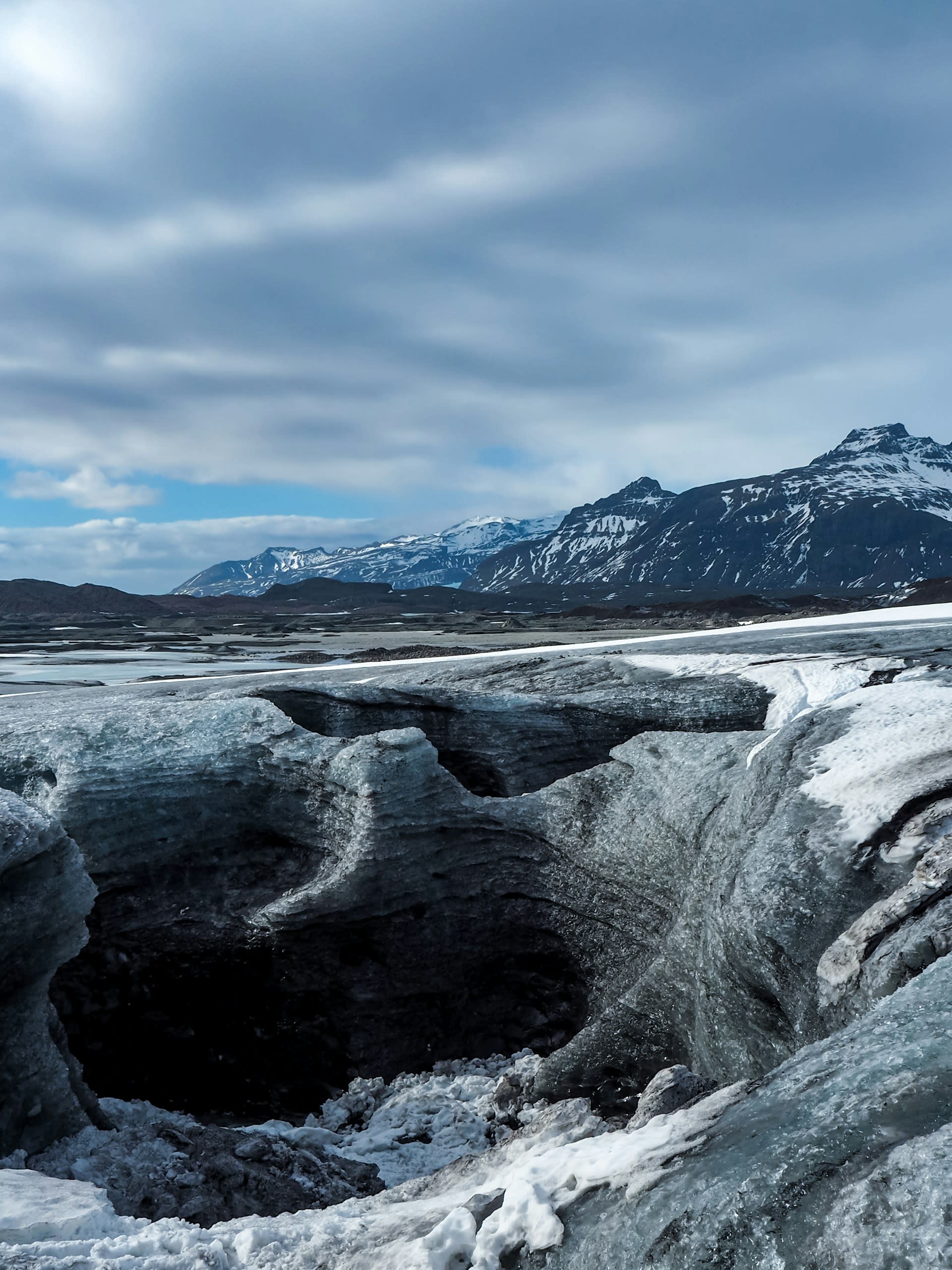
Vatnajökull National Park covers 14,141 km² of southeast and central Iceland — approximately 14% of Iceland's total land area and the largest national park in Europe. Its centrepiece is Vatnajökull, the largest glacier in Iceland and the largest in Europe outside the Arctic Circle — an icecap of 7,700 km² and up to 950 m deep covering several active volcanoes including Grímsvötn (the most active volcano in Iceland) and Bárðarbunga. The combination of ice and fire — active volcanic eruptions beneath glacial ice creating explosive subglacial eruptions (jökulhlaups) and ice caves from geothermal heat — gives Vatnajökull its unique geological character. The park encompasses several of Iceland's most celebrated landscapes: the Jökulsárlón glacial lagoon where icebergs from Breiðamerkurjökull calve into a diamond-studded lake before floating to sea; the Skaftafell area with its black sand desert and birch woodland beneath the glacier; the Jökulsá á Fjöllum canyon system (Jökulsárgljúfur) in the north with Dettifoss — Europe's most powerful waterfall; and the Landmannalaugar rhyolite highlands of vivid red, yellow, and green coloured mountains in the park's western annexe.
🌍 Geography and Ecosystem
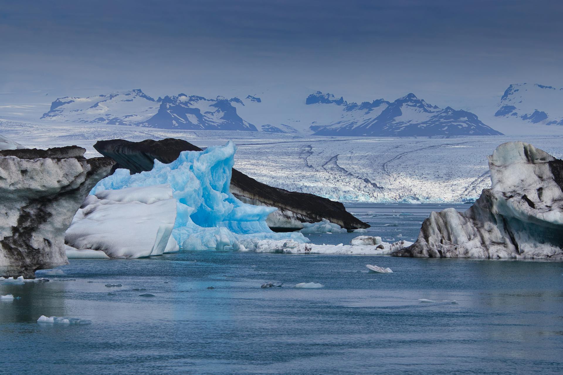
- Jökulsárlón Glacial Lagoon: The Jökulsárlón (Glacier River Lagoon) is a 20 km² lake at the terminus of Breiðamerkurjökull outlet glacier — formed entirely since 1935 as the glacier retreated from the coast, and growing by 1–2 km per decade. Icebergs calved from the glacier face drift slowly across the lagoon (some remaining for years before melting), then float through the short outlet channel to the black sand beach of Diamond Beach, where they strand as glistening ice chunks on the dark sand. The visual contrast of transparent blue ice on black volcanic sand with the Atlantic surf behind is one of Iceland's most extraordinary landscape compositions.
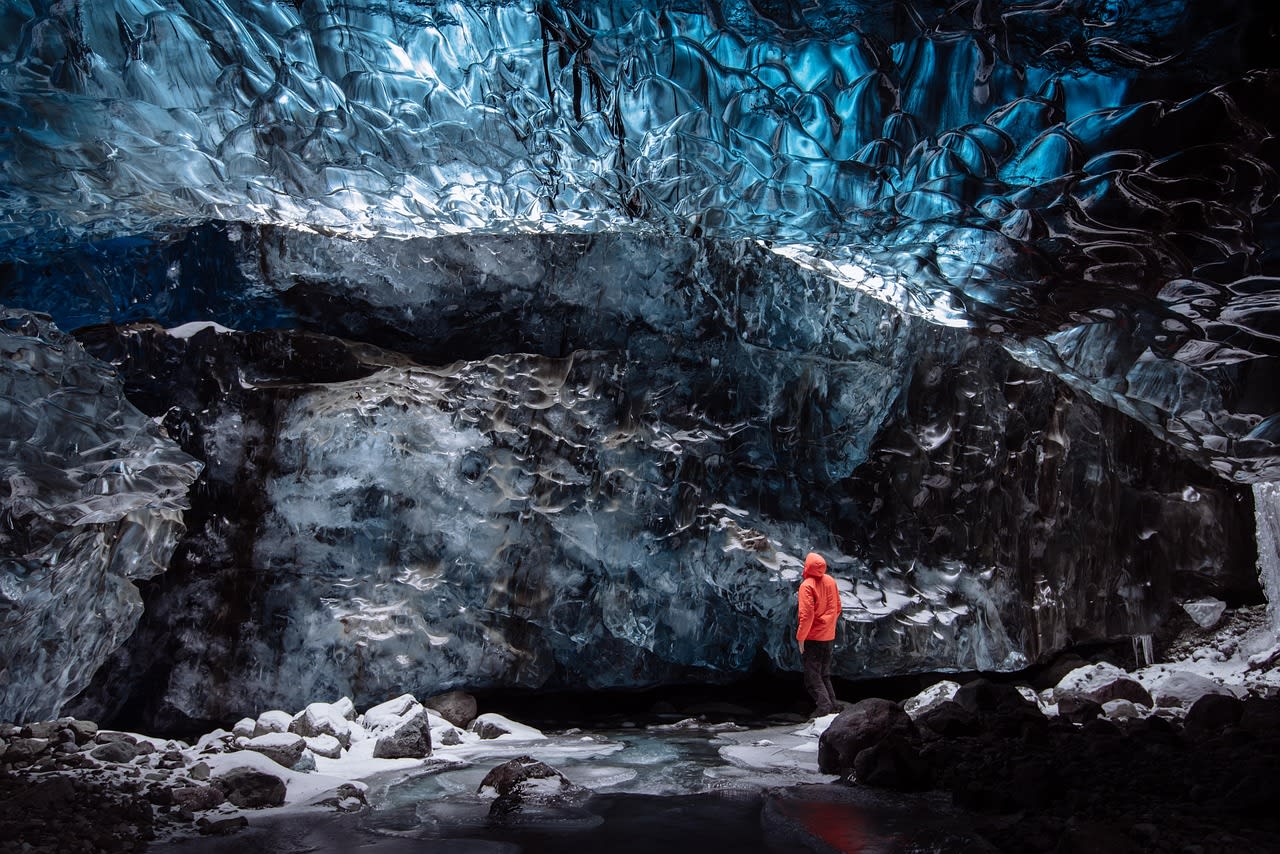
- Ice Caves (Vatnajökull): The glacial outlet tongues of Vatnajökull — particularly Breiðamerkurjökull, Falljökull, and Svínafellsjökull — develop natural ice caves in winter (October–March) when meltwater drainage creates hollow chambers within the ice body. The cave interiors are illuminated with deep blue light filtered through the compressed glacier ice above — creating otherworldly spaces of cobalt and turquoise that are among the most visually compelling natural interiors anywhere on Earth. Ice cave tours with certified guides depart from Skaftafell and Jökulsárlón daily from October to March.
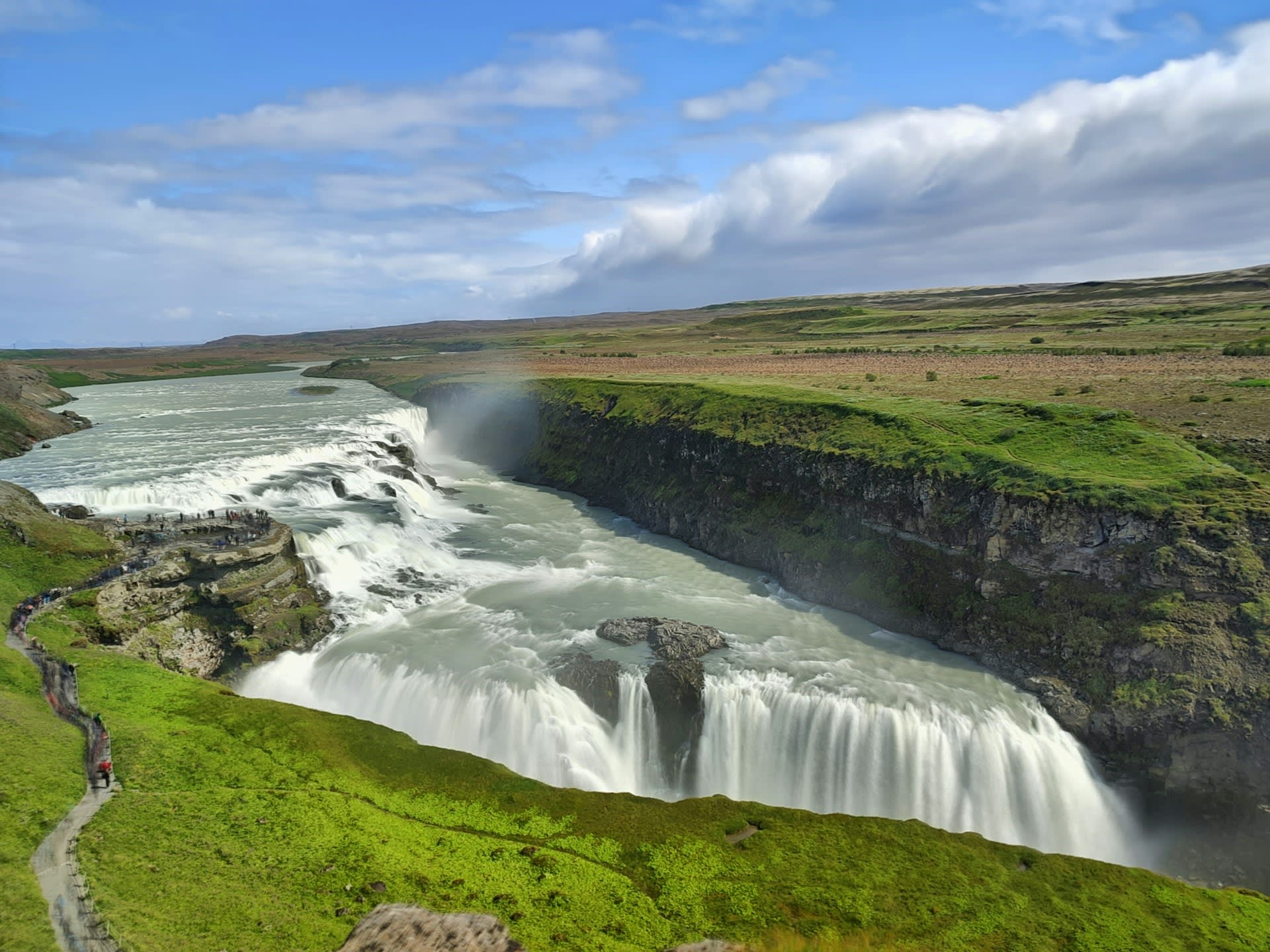
- Dettifoss: Dettifoss in the northern section of the park (Jökulsárgljúfur canyon) is Europe's most powerful waterfall by volume — approximately 193 m³/s of glacial meltwater plunges 44 m into the canyon of the Jökulsá á Fjöllum river, which itself was carved by catastrophic glacial floods in the last ice age. The raw power of Dettifoss — felt as ground vibration from the viewpoint 50 m away — and the grey basalt walls of the surrounding canyon create a landscape of elemental force that has no comparable equivalent in Europe. The falls were used as the opening scene of Ridley Scott's Prometheus (2012).
- Landmannalaugar: The Landmannalaugar area in the park's southwestern annexe is a highland rhyolite landscape of extraordinary colour — mountains of red, yellow, pink, and moss-green volcanic rock contrasted with black lava fields and white snow patches. Landmannalaugar is the start of the Laugavegur trail — Iceland's most celebrated multi-day hike (55 km, 4 days to Þórsmörk) — and has a natural geothermal pool at 40°C where hikers soak after trail days. The combination of coloured rhyolite mountains, steaming fumaroles, and the geothermal pool makes Landmannalaugar the most visually diverse single highland location in Iceland.
📜 History and Cultural Significance
The Skaftafell area within the park was historically one of Iceland's most important farming districts — its sheltered position beneath the glacier and relative warmth (the icecap provides shelter from northerly winds) made it more agriculturally productive than surrounding areas, and the farms established here in the saga age continued through the 20th century. Skaftafell became Iceland's first national park in 1967; the park was expanded into the full Vatnajökull National Park in 2008 when the southern Skaftafell park and the northern Jökulsárgljúfur park were merged.
🏃 Activities and Attractions
- Jökulsárlón Iceberg Boat Tour: Amphibious boat and zodiac inflatable tours navigate the Jökulsárlón lagoon among the drifting icebergs — approaching calving fronts, touching ice, and observing the seals (harbour and grey seals) that rest on the floating bergs. The scale of the icebergs — some 10–15 m above the water, representing 90% more below the surface — is comprehensible only at water level. Dawn visits to Diamond Beach (free, no guide needed) for the ice-on-black-sand photographs are possible year-round without a boat tour.
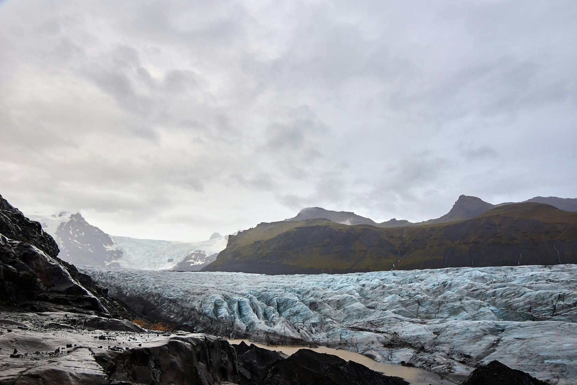
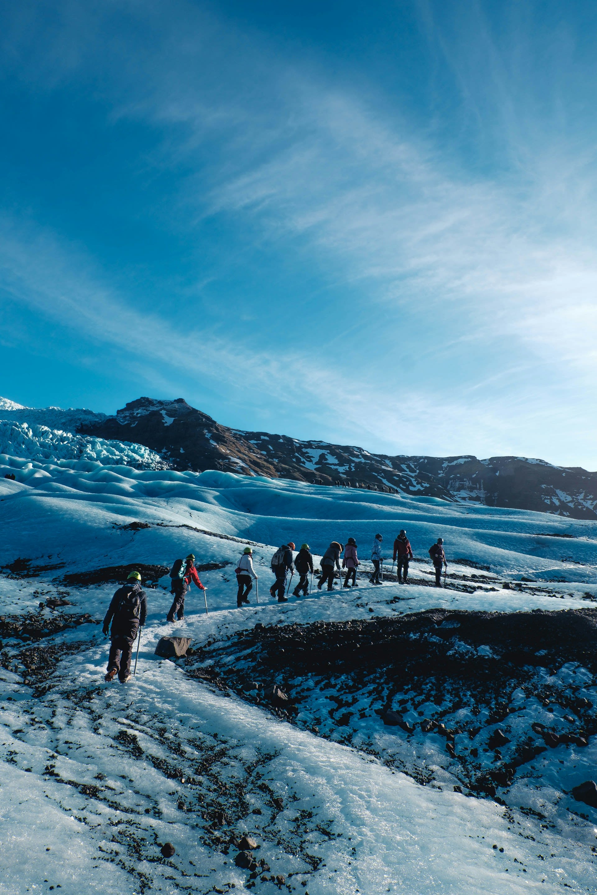
- Glacier Hiking at Skaftafell: The Skaftafell area provides direct access to the ice face of Svínafellsjökull glacier — a 3 km walk from the visitor centre reaches the ice edge, where guided glacier walks (2–3 hours on ice with crampons provided) allow safe exploration of the glacier surface. The Svartifoss waterfall (2.3 km from car park) falls over hexagonal basalt columns of extraordinary regularity, its shape inspiring several elements of Hallgrímskirkja church in Reykjavík.
- Ice Cave Tours (October–March): Guided ice cave tours from Jökulsárlón and Skaftafell into the natural caves within Breiðamerkurjökull glacier are the most popular winter activity in south Iceland — small groups with certified glacier guides access blue ice chambers accessible only in winter when meltwater drainage is at minimum. Booking is essential (tours sell out 2–3 weeks ahead in peak winter).
- Laugavegur Trail Hiking: The 55 km Laugavegur trail from Landmannalaugar to Þórsmörk (4 days) is Iceland's most celebrated trekking route — traversing the rhyolite highlands, crossing glacial rivers, descending into the birch woodland of Þórsmörk, and providing the full range of Iceland's highland landscape in a single continuous walk. The trail is open June to mid-October; mountain huts at regular intervals provide accommodation (book through Ferðafélag Íslands months in advance for July–August).
💡 Travel Tips
Best Season: June–August for Laugavegur hiking and Landmannalaugar (open highland roads). October–March for ice caves (best December–February for largest cave development). Jökulsárlón is outstanding year-round but most dramatic in winter with blue ice against snow and the possibility of aurora above the lagoon. Dettifoss is accessible year-round but the falls are most powerful in June (spring snowmelt).
Icelandic Highland Road (F-roads): Landmannalaugar and the interior routes require 4WD vehicles — the F210 and F208 mountain roads are closed to conventional vehicles and open only June–September depending on conditions. Check road.is for current F-road status before attempting highland access.
🌱 Conservation
The park also faces management pressure from rapid visitor growth — Iceland's tourism more than quadrupled between 2010 and 2019, and the park's most accessible sites (Jökulsárlón, Skaftafell, Diamond Beach) have become heavily crowded in summer. Infrastructure expansion to manage visitor numbers has been carefully controlled to avoid over-development in the core wilderness areas, but parking, trail erosion, and the carrying capacity of the glacier guide services at peak periods are ongoing management concerns.