Þingvellir National Park
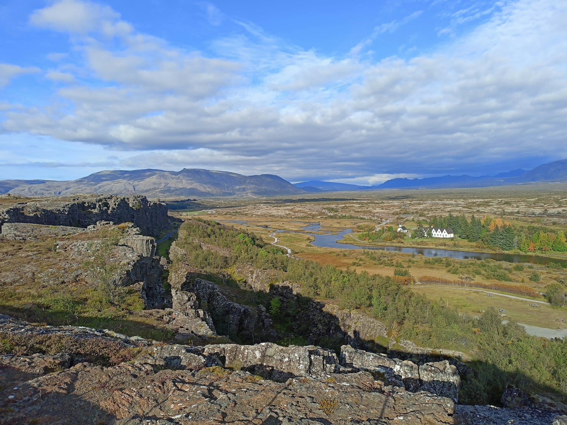
Þingvellir National Park occupies an extraordinarily convergent territory in southwestern Iceland where geology and human history are literally written in the same landscape. The park protects a graben rift valley formed by the divergence of the North American and Eurasian tectonic plates, a process still occurring at 2.5 cm per year and visible in the parallel fault fissures that run through the park. Yet the same geological drama that creates its scientific significance also created the natural amphitheatre where, in 930 CE, Iceland's founding settlers established the Alþingi — the world's first democratic parliament, which would meet continuously for over 300 years. Inscribed on the UNESCO World Heritage List in 2004, Þingvellir was simultaneously the first Icelandic national park (1930) and is the only UNESCO World Heritage Site designated for both its cultural and geological values together. Iceland's parliament was restored to Þingvellir for two symbolic sessions in 1944 (independence from Denmark) and 1974 (the 1,100th anniversary of settlement).
🌍 Geography and Ecosystem
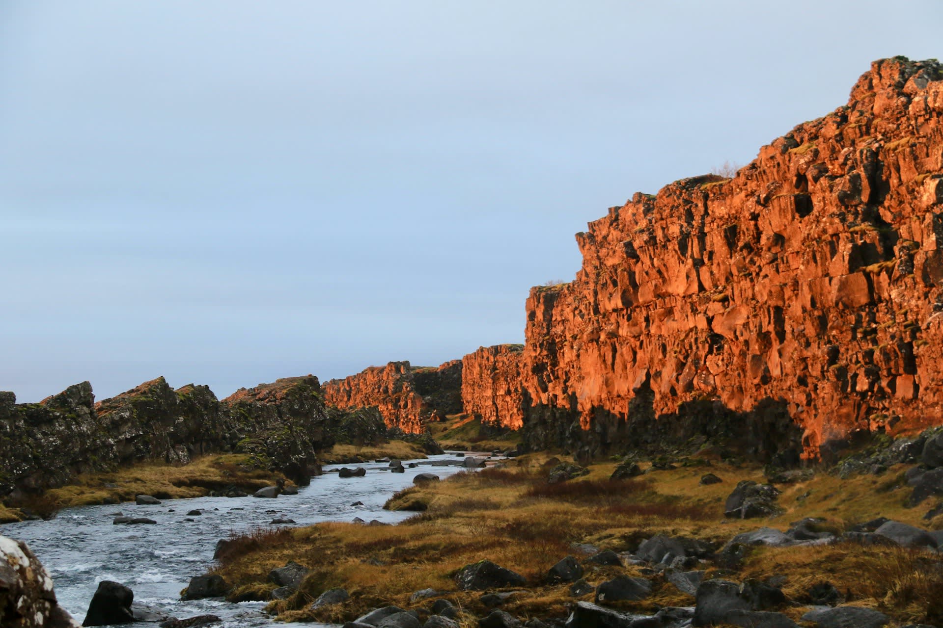
- Almannagjá Gorge: The principal rift fissure forming the western boundary of the park, 7.7 km long and up to 32 metres deep. The walking path through the gorge passes the Lögberg (Law Rock) — a natural promontory from which the Law Speaker recited the laws to assembled parliamentarians for the Alþingi. The acoustic properties of the gorge walls amplified his voice across the assembled crowd. A flagpole now marks the approximate location of the original rock, which subsided and was reclaimed by the lake.
- Silfra Fissure: A water-filled crack in the Þingvellir lakebed, 63 metres deep, filled with glacier meltwater that has filtered through the Langjökull ice cap's lava rock for 30–100 years. The filtering process removes all suspended particles, producing horizontal visibility exceeding 100 metres — some of the clearest freshwater on Earth. The temperature year-round is 2–4°C.
- Öxárárfoss Waterfall: A small but photogenic waterfall on the Öxará river near the northern end of the Almannagjá gorge, framed by vertical basalt columns. The pool below the falls — Drekkingarhylur (Drowning Pool) — was used for the execution of women convicted of serious crimes during the Alþingi period, typically by drowning in a sack.
- Arnarfell Ridge: The elevated plateau northwest of the main visitor area, reached by a 7-km hiking trail, providing panoramic views of the entire rift valley structure, Þingvallavatn, and on clear days, the Snæfellsjökull glacier 120 km to the northwest. The ridge illustrates clearly the parallel fault geometry of the Mid-Atlantic Ridge at this point.
📜 History and Cultural Significance
The conversion of Iceland to Christianity in 1000 CE was decided at the Alþingi in a single dramatic session, in which the Law Speaker Þorgeirr Ljósvetningagoði, a pagan, retired under his cloak for a day and night before emerging to declare Christianity the official religion — with private pagan worship permitted — in order to prevent civil war between the two factions. The Alþingi continued to meet at Þingvellir until 1798, when sessions were transferred to Reykjavík. The site was declared a protected area in 1928 and Iceland's first national park in 1930 on the 1,000th anniversary of the parliament's foundation.
🏃 Activities and Attractions
- Silfra Snorkelling and Diving: The defining adventure activity of Þingvellir — floating or diving through the Silfra fissure in 2°C water of extraordinary clarity, physically touching both the North American and Eurasian tectonic plates simultaneously. Dry suit snorkelling tours require no diving certification and are available year-round. PADI open water certification is required for the dive tour. All equipment provided; bookings required well in advance.
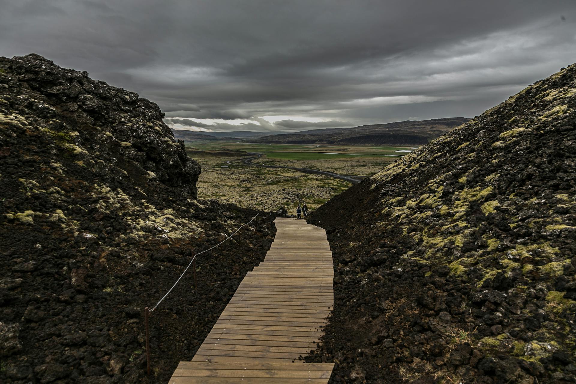
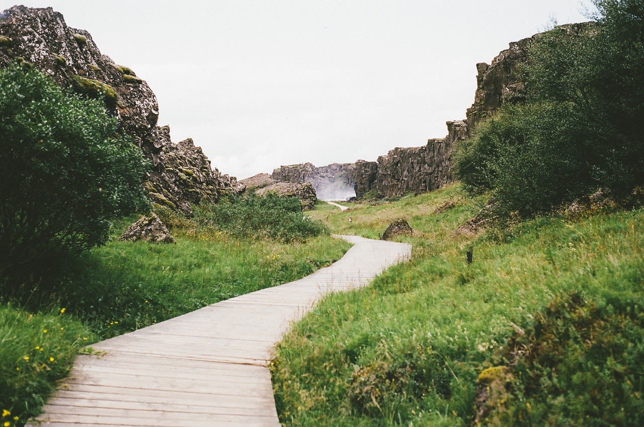
- Almannagjá Gorge Walk: The park's primary self-guided walk follows the gorge from the main visitor centre south to the Öxará river mouth, passing the Lögberg site, Öxárárfoss waterfall, and Drekkingarhylur pool. The 2.5-km one-way walk (5 km return) takes 1–2 hours and is suitable for all ages. Interpretive panels explain the geological and historical significance of each feature.
- Birdwatching: Þingvallavatn and its surrounding wetlands are an important breeding area for over 40 species including great northern diver, Slavonian grebe, tufted duck, harlequin duck, and Barrow's goldeneye — the latter having its only European breeding population in Iceland. The lake margins are best visited early morning in May–July.
- Fishing: Þingvallavatn's Arctic char fishery is managed under a strict permit system that limits annual catch to protect the four endemic morphs. Day permits for the summer season sell out extremely quickly — apply through the Þingvellir National Park authority from 1 March each year.
- Aurora Viewing from Þingvellir: The dark skies over the rift valley and the reflective surface of Þingvallavatn create exceptional aurora viewing conditions from September through March. The ION Adventure Hotel on the lake's northern shore has geothermal outdoor hot tubs positioned for optimal aurora viewing and offers guided photography sessions.
💡 Travel Tips
Best Season: Year-round. Summer (June–August) for midnight sun, hiking, and wildflowers. September–October for autumn colour and early aurora season. Winter for aurora and frozen landscape photography — the gorge paths are cleared of snow and accessible year-round.
Silfra Booking: Silfra tours with licensed operators (DIVE.IS, Arctic Adventures, Troll Expeditions) must be booked at least 2–4 weeks in advance in summer. Minimum age for snorkelling is 12, diving 18. Height and weight restrictions apply for drysuit sizing.
Accommodation: The Þingvellir campsite (open May–September) is one of Iceland's most atmospheric camping locations, with views of the rift valley. The ION Adventure Hotel (boutique, high-end) is located on the lake shore 5 km from the main visitor area. Reykjavík (50 km) has the widest accommodation choice.
🌱 Conservation
The Silfra fissure dive operation is the most tightly managed activity: permitted operators are limited in number, dive groups are small (maximum 6), and the strict prohibition on touching the fissure walls or disturbing the lakebed is enforced through diver briefings and guide supervision. The four endemic Arctic char morphs in Þingvallavatn are monitored annually by the University of Iceland's Institute of Biology, with the murta morph — a piscivorous form found only in the deepest part of the lake — considered particularly sensitive to temperature change. Warming of the lake by 0.8°C since 1980 is already affecting the thermal stratification that maintains the morph separation, and the long-term genetic consequences of increased habitat overlap are under active study.