Caprivi Strip
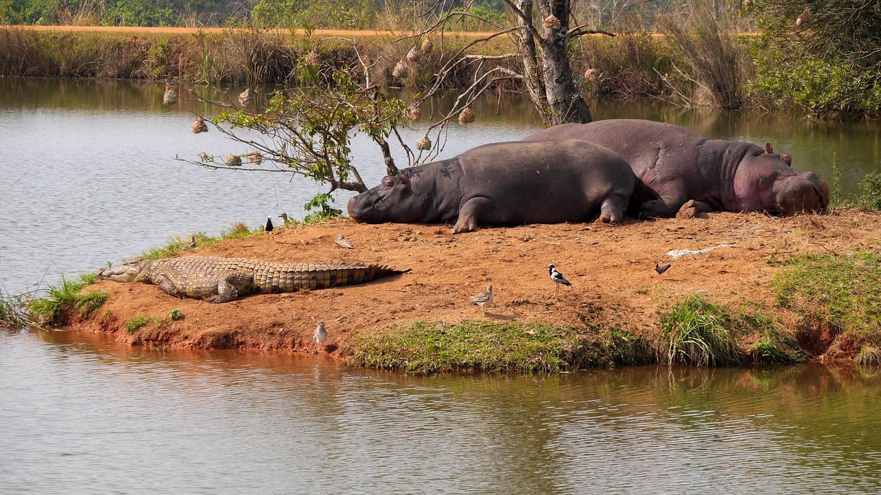
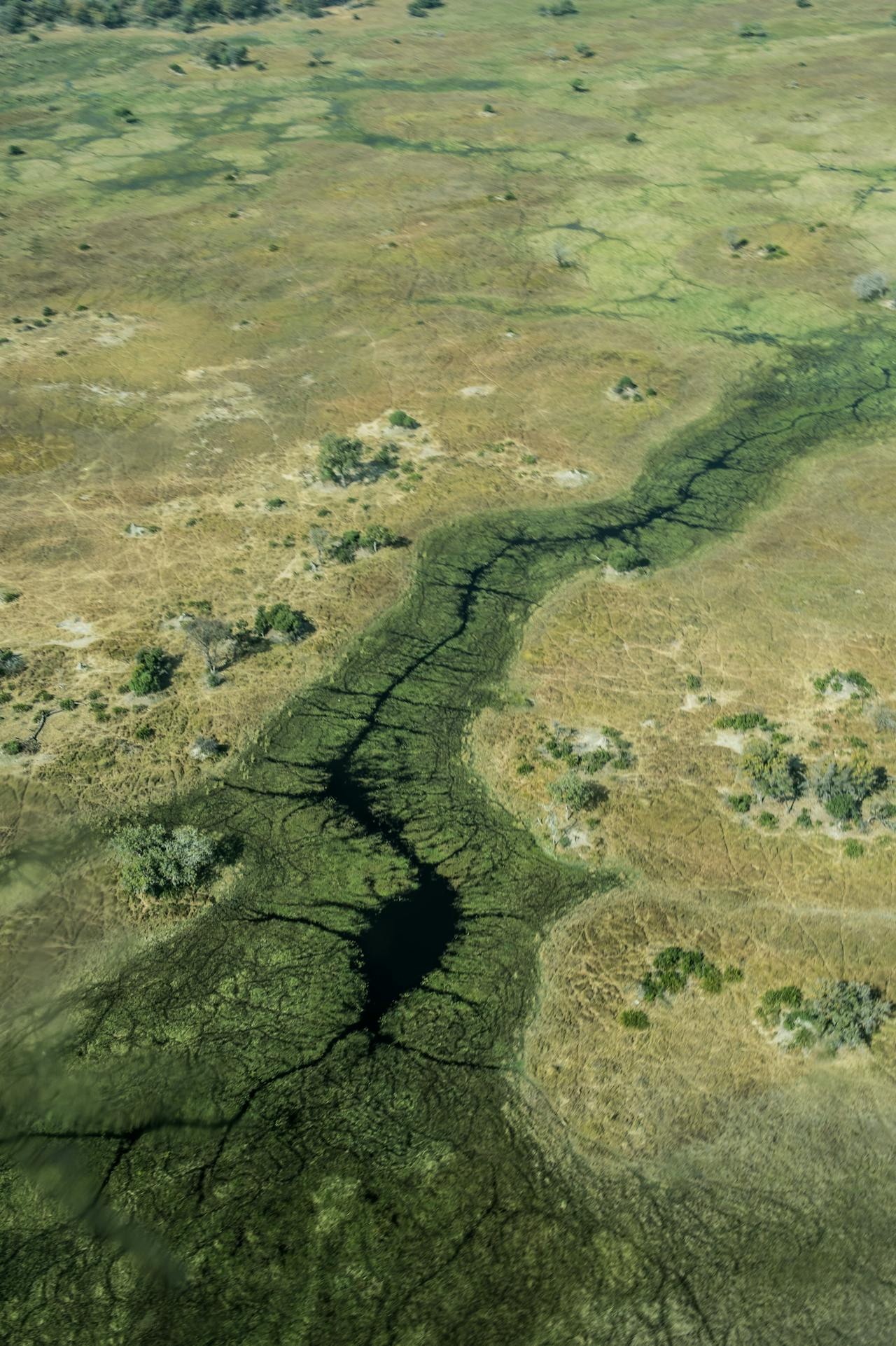
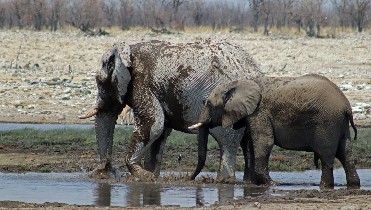
The Caprivi Strip — officially the Zambezi Region since 2013 — is a narrow 450 km panhandle of Namibian territory projecting east between Angola, Botswana, Zambia, and Zimbabwe, designed in 1890 to give German South West Africa access to the Zambezi River. The strip is a world apart from the rest of Namibia: instead of desert, it is a lush floodplain landscape of mopane woodland, riverine forest, and permanent water channels fed by the Okavango, Kwando, Linyanti, and Chobe rivers that define its boundaries. The result is one of southern Africa's most important wildlife corridors — the Kavango-Zambezi Transfrontier Conservation Area (KAZA), the world's largest transboundary conservation area at 520,000 km² spanning five countries, has its heart in the Caprivi Strip. The region hosts large elephant populations (the Chobe-Caprivi ecosystem holds the world's largest savanna elephant concentration), hippo, buffalo, lion, leopard, wild dog, and over 600 bird species — one of the highest bird diversities of any terrestrial site in Africa.
🌍 Geography and Ecosystem
- Bwabwata National Park: A unique park divided into two sections — the Mahango Core Area (in the west, a dry-season elephant concentration area on the Okavango River) and the Buffalo Core Area (in the east on the Kwando-Linyanti system). Between the two core areas, a 'multiple use zone' allows communal farming and wildlife to coexist on the same land — a model that provides a buffer corridor between the two protected areas while generating income for local Khwe and Hambukushu communities.
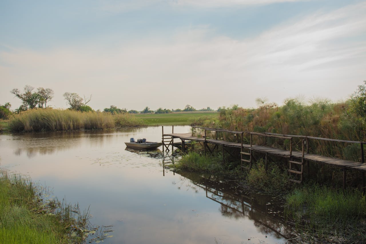
- Mudumu and Nkasa Rupara National Parks: Two smaller parks in the eastern Caprivi protecting floodplain habitats of the Kwando River system. Nkasa Rupara (formerly Mamili) is particularly notable as Namibia's equivalent of the Okavango Delta — a complex of islands, lagoons, and papyrus channels forming the most extensive floodplain wetland in Namibia. Wild dog, lion, and lechwe antelope are key species.
- Birding: The Caprivi holds over 600 bird species — more than any other area of Namibia and comparable to the Okavango Delta. The African skimmer breeds on sandbanks in the Okavango and Kwando rivers; the slaty egret (Endangered globally) feeds in the shallow floodplains; the Pel's fishing owl hunts along the larger river channels. The region is the southern limit for several central African species and the northern limit for several Kalahari-adapted species, creating an extraordinary overlap zone.
- KAZA Transfrontier Area: The Caprivi lies at the junction of the world's largest transboundary conservation area — KAZA encompasses Chobe National Park (Botswana), Hwange National Park (Zimbabwe), Kafue National Park (Zambia), and the Okavango Delta (Botswana). Wildlife moves freely across the borders: elephant herds tracked in Namibia are found in Botswana days later; wild dog packs born in Zimbabwe establish territories in Namibia. This landscape-scale connectivity is what makes the Caprivi wildlife system genuinely viable long-term.
📜 History and Cultural Significance
The indigenous inhabitants of the Caprivi are the Subiya, Mafwe, Mbukushu, and Khwe San peoples, who have lived along the rivers for centuries as fishermen, farmers, and hunter-gatherers. The strip saw fighting during the South African Border War (1966–1989) when SWAPO guerrillas used it as an infiltration route from Zambia and Angola — landmines from this period are still occasionally encountered in the bush. After Namibian independence in 1990, a brief secessionist insurgency in 1999 sought to split the Caprivi from Namibia, claiming cultural distinctiveness from the rest of the country. The region was renamed the Zambezi Region in 2013 to reduce the association with German colonialism.
🏃 Activities and Attractions
- Mokoro and Boat Safaris: Exploring the floodplain channels and lagoons of Nkasa Rupara by mokoro (dugout canoe) is the most intimate way to engage with the Caprivi wetlands — approaching hippo pods and sitatunga antelope in reed beds, drifting past nesting African skimmers, and experiencing the sounds and scale of the floodplain at water level. Motorboat safaris on the larger Okavango and Kwando channels allow longer distances with game drives along the riverbanks.
- Tiger Fishing on the Zambezi: The Zambezi, Okavango, and Chobe rivers of the Caprivi are among southern Africa's finest freshwater fishing destinations for tigerfish (Hydrocynus vittatus) — a powerful, razor-toothed predatory fish that fights with acrobatic aggression when hooked. The tigerfish season peaks August–October when water levels are lowest. Catch-and-release is standard practice. The river camps around Katima Mulilo offer guided fishing by boat with local specialists.
- Popa Falls and Mahango Core Area: The Popa Falls — a series of rapids rather than a single waterfall on the Okavango River near Divundu — mark the entrance to the Mahango Core Area of Bwabwata National Park. The core area is one of the best places in Namibia to observe large elephant herds at close range at the Okavango riverbank, and the fig forest along the river is outstanding for birding including Pel's fishing owl, African finfoot, and Retz's helmetshrike.
- Cultural Visits to Khwe San Communities: The Khwe San of the western Caprivi's Buffalo Core Area are among the few remaining San communities in Namibia with active hunter-gatherer knowledge — their community conservancy (the Kyaramacan Association) manages tourism on their ancestral lands and offers guided walks demonstrating traditional plant use, tracking, and fire-making. These are authentic community-controlled experiences rather than staged cultural shows.
- Four Countries in One Day: Katima Mulilo, the regional capital, sits at the point where Namibia, Botswana, Zambia, and Zimbabwe meet at Kazungula. A road bridge now connects Botswana and Zambia at this point; boat trips reach all four countries in a single morning, and the nearby town of Livingstone (Zambia) and Victoria Falls (Zimbabwe/Zambia) are a comfortable day trip from the eastern Caprivi's lodges.
💡 Travel Tips
Best Season: May–October (dry season) for best wildlife viewing — animals concentrate at rivers during the dry months. July–September is optimal with cooler temperatures (10–28°C) and excellent visibility in the dry mopane woodland. November–April brings the rainy season — many lodges reduce rates, birding reaches its peak (breeding plumage), but some tracks become impassable and mosquito density increases significantly. Malaria prophylaxis is essential year-round in the Caprivi.
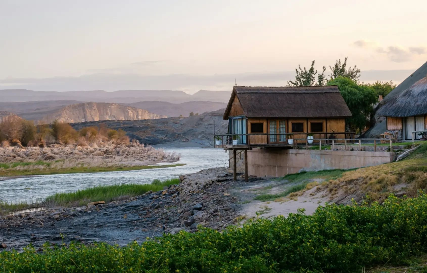
Accommodation: The Caprivi has a well-developed lodge network ranging from luxury safari camps (Nambwa Tented Lodge on a private island, Susuwe Island Lodge) to mid-range riverside camps and basic restcamps in the national parks. The NamibiaWildlife Resorts camps at Popa Falls and Mahango are budget-friendly. All accommodation should be booked in advance for July–September.
🌱 Conservation
Community conservancies in the Caprivi — established under Namibia's innovative 1996 communal conservancy legislation — have been effective in reducing poaching by giving communities economic stakes in wildlife protection. The IRDNC (Integrated Rural Development and Nature Conservation) has supported conservancy development across the Caprivi for 30 years, documenting wildlife recovery following the end of the Border War. Elephant populations have increased significantly since the 1990s — with the associated challenge of human-elephant conflict as the expanding herds increasingly raid crops and raid cattle posts in the farming zones between protected areas.