Tianchi Lake
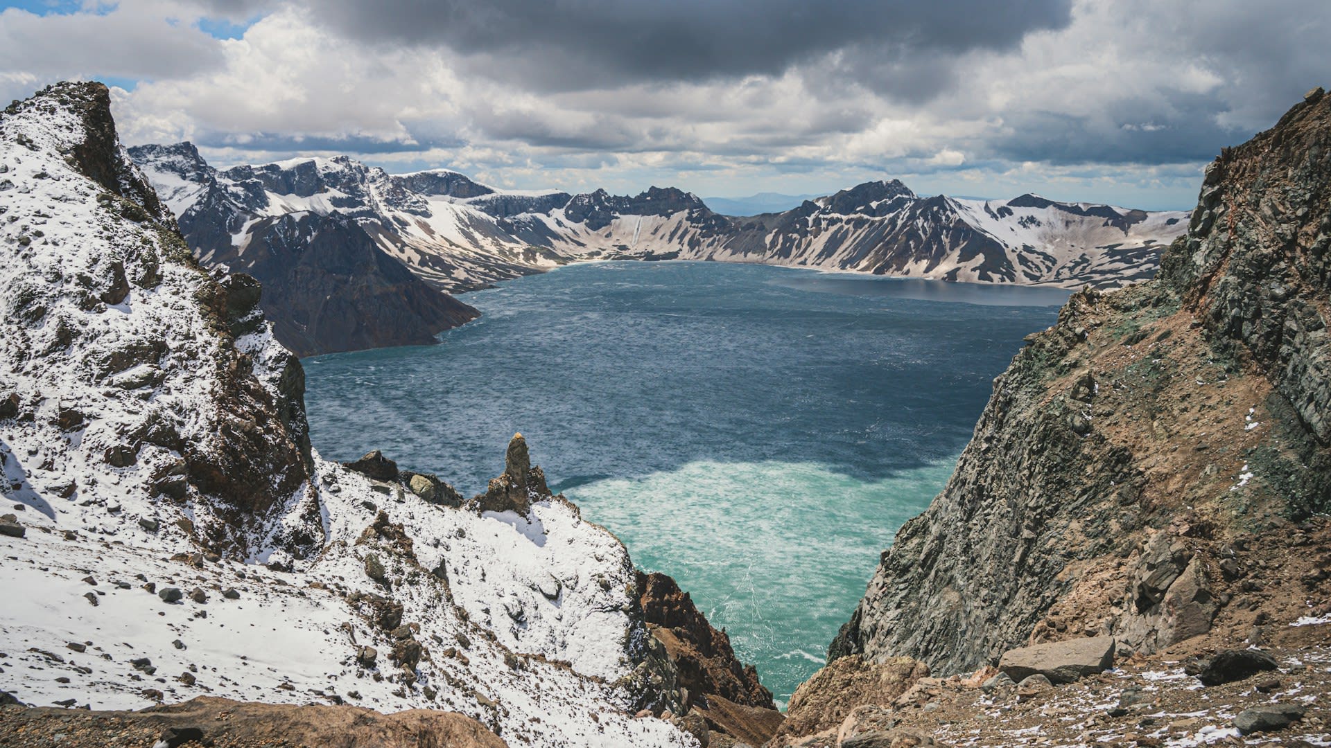
Tianchi (天池 — 'Heaven Lake') is a volcanic crater lake sitting at 1,910 metres within the caldera of Baekdu-Changbai Mountain (called Paektu-san in Korean, Changbai Shan in Chinese) — a massive stratovolcano straddling the border between China's Jilin Province and North Korea. The lake fills a caldera formed by the 946 AD Millennium Eruption — one of the largest volcanic eruptions in the last 10,000 years globally, depositing volcanic ash as far as Japan and across the Korean Peninsula, and creating the 4.5 km diameter caldera now occupied by the lake. The eruption's tephra layers are found in sediment cores across the region and serve as a geological marker horizon for the mid-10th century. At 2,189 m, the surrounding caldera rim (shared between China and North Korea) is the highest point in northeastern China and the highest point on the Korean Peninsula. The lake — 9.82 km² and 384 metres deep — is geothermally active: the water temperature at the surface is 7–10°C but bottom temperatures reach 42°C from geothermal heating, and the lake never freezes despite the extreme winter climate. It is sacred to both the Korean and Manchu peoples.
🌍 Geography and Ecosystem
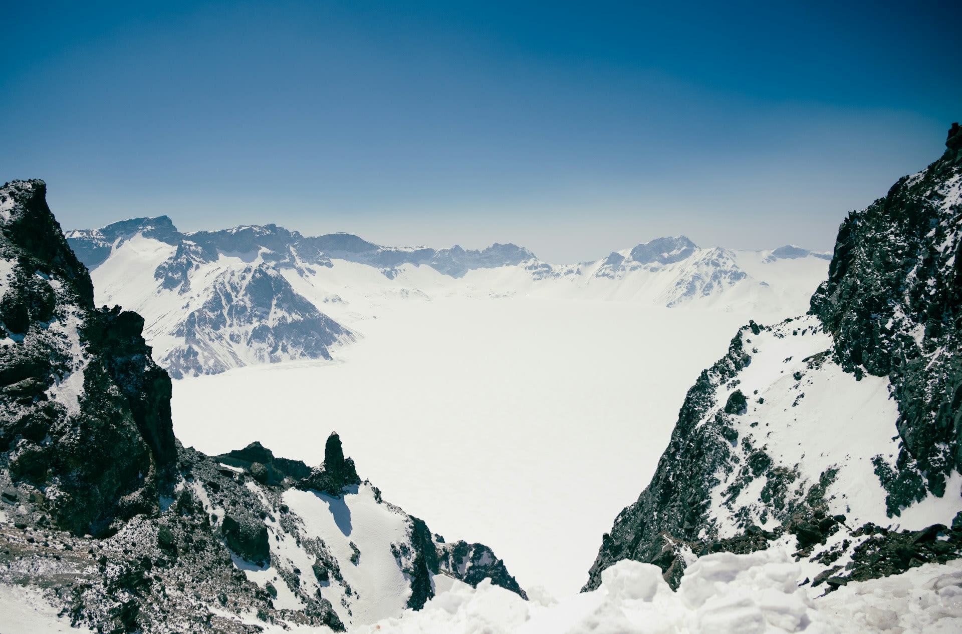
- The Caldera Rim View: The standard visitor experience — taking the mountain road to the caldera rim at 2,100–2,189 m and looking down into the lake below. On clear days (relatively rare — cloud typically covers the summit 70–80% of the time) the view is extraordinary: deep blue water in a perfect volcanic bowl, snow on the caldera walls, and the sense of standing on the rim of an active volcano that last erupted catastrophically in 1903 (a minor eruption) and shows geothermal activity continuously. Clear windows are most likely in July–August and in early September.
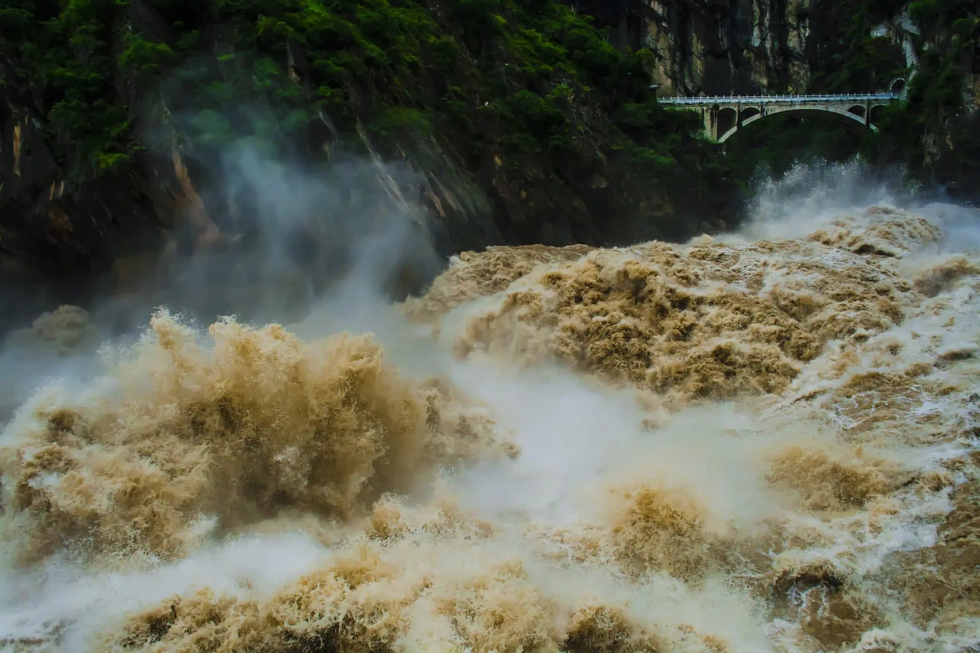
- Changbai Waterfall: The lake's overflow escapes through a notch in the caldera's northern wall, dropping 68 m as the Changbai Waterfall — China's highest waterfall. The waterfall is spectacular in summer and ice-encrusted in winter; the approach involves a 20-minute walk through the crater zone below the caldera wall. The water temperature (warmed by geothermal activity in the lake) keeps the river below the falls flowing even in the coldest winter months.
- Changbai Nature Reserve Forest: The slopes of Changbai Mountain below the caldera zone are clothed in one of the most species-rich temperate forests in northeastern Asia — a vegetation sequence transitioning from mixed broadleaf (Korean pine, Mongolian oak, Manchurian ash) through boreal conifer to subalpine birch and dwarf pine, then the bare volcanic summit zone. The forest is habitat for Siberian tiger (extremely rare), Amur leopard (critically endangered), brown bear, and the red-crowned crane in the adjacent wetlands of the Tumen River system.
- Underground Forest (Underground River): A volcanic lava tube system on the mountain's north slope — the 'Underground Forest' — created when a lava flow cooled on the surface while molten lava continued flowing underneath, leaving a tube 100 m wide and 6 m high that has subsequently been colonised by cold-tolerant forest. Accessible by short boardwalk, it is an unusual subterranean ecology that complements the dramatic surface landscape.
📜 History and Cultural Significance
In Manchu cultural tradition, Changbai Mountain was the ancestral homeland of the Manchu people — the Qing dynasty (1644–1912) considered it the sacred mountain of origin and protected it as imperial hunting ground, forbidding Han Chinese settlement on the mountain for centuries. The Qing emperors conducted annual sacrifices at the mountain's shrines. After the fall of the Qing dynasty, the mountain became part of the Jilin Province border region and was opened to Han settlement and later to state-managed nature reserve status. The border between China and North Korea passes through the lake, with China controlling the northern 54% and North Korea the southern 46%.
🏃 Activities and Attractions
- North Slope Summit View of Tianchi: The primary visitor experience — taking the tourist bus up the north slope road to the caldera rim and waiting for a clear window in the cloud to reveal the lake below. The summit area is notoriously cloudy; patience is rewarded when the cloud briefly clears to reveal the full caldera. Multiple viewpoints on the north rim provide different angles on the lake and the caldera wall, including the North Korean territory on the southern rim visible across the water.
- West Slope Sunrise Hike: The west slope access — longer and less developed — allows a pre-dawn approach to the caldera rim for sunrise views. The dawn light on clear days illuminates the lake in shades of pink and gold before cloud typically forms around 08:00–09:00. This approach requires booking a local guide from Baihe town and a very early start (03:30–04:00) but offers the most spectacular conditions with the fewest visitors.
- Changbai Waterfall and Hot Spring Zone: Below the caldera, the north slope visitor zone includes the Changbai Waterfall, several natural hot spring pools (geothermal water at 60–80°C visible as steaming streams among the pine forest), and the Underground Forest lava tube. A full-day itinerary can include all three without requiring a summit approach — useful as a backup on cloudy summit days.
- Changbai Mountain Ski Resort: The northern slopes receive substantial snowfall (October–April) and support one of northeastern China's major ski resorts with 28 pistes and 2,000 m of vertical. Winter visits combine skiing with the extraordinary experience of the volcanic landscape under snow. January–February temperatures drop to −30°C; the geothermal hot spring baths provide a warm counterpoint.
- Yanbian Korean Autonomous Prefecture Cultural Visit: The Yanbian Korean Autonomous Prefecture surrounding Changbai Mountain is home to 800,000 ethnic Koreans — the largest Korean diaspora community outside the Korean Peninsula. Yanbian maintains Korean-language schools, Korean cuisine, and cultural traditions that reflect both the historical migration from the Korean Peninsula and the distinctly Chinese political context. A visit to Yanji city (the prefecture capital) provides cultural depth to the Changbai Mountain experience.
💡 Travel Tips
Best Season: June–September for the best chance of clear skies at the summit (though even in summer, cloud-free days at the caldera are rare — estimated 60–70 days per year). July–August for maximum green forest and summer wildflowers on the slopes. October for autumn leaf colour on the north slope forest. January–March for skiing and the extraordinary winter landscape of frozen waterfalls and snow-covered volcanic terrain.
Photography: The summit area cloud conditions require patience and multiple attempts for a clear lake view. Arrive at the rim early (07:00–08:00) before convective clouds form, or try at dusk after afternoon clouds clear. The autumn colour season (late September–mid October) offers the best combination of clear skies and dramatic foreground interest from the golden and red broadleaf forest against the volcanic summit.
🌱 Conservation
The volcano itself presents an ongoing natural hazard — Changbai/Paektu-san erupted in 946, 1668, and 1702, and shows continuous hydrothermal activity. Seismic swarms in 2002–2005 raised international concern about the possibility of a major eruption, which would have catastrophic consequences for both Chinese and North Korean communities in the surrounding lowlands. The North Korean side of the mountain is not accessible to international scientists, creating gaps in the volcano monitoring network that complicate eruption risk assessment.