Tatra Mountains
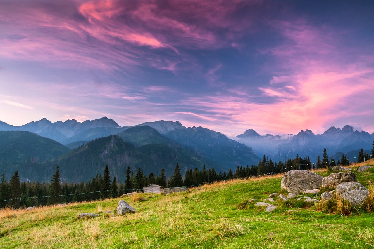
The Tatra Mountains (Polish: Tatry) form the highest massif of the entire Carpathian chain, rising to 2,499 metres at Rysy on the Polish-Slovak border — the highest point on Polish territory. Covering approximately 785 km² across the two countries, the Tatras are a compact but geologically intense mountain range of granite intrusions, limestone karst, and glacially-carved cirques that give Central Europe its only true alpine landscape. The Polish side (Tatrzański Park Narodowy, 212 km²) was declared a national park in 1954 and has been a UNESCO Biosphere Reserve since 1992, protecting the full altitudinal zonation from subalpine spruce forest at 1,000 metres through dwarf pine scrub and high alpine meadow to bare rock and permanent snowfields at the summits. The Tatras form the spiritual heartland of Polish mountain culture and the backdrop to Zakopane — the mountain town of 27,000 inhabitants at the foot of the range, whose distinctive Zakopane Style architecture (carved wood gables, decorated eaves) and highland culture of the Górale (mountain folk) are as celebrated as the mountains themselves.
🌍 Geography and Ecosystem
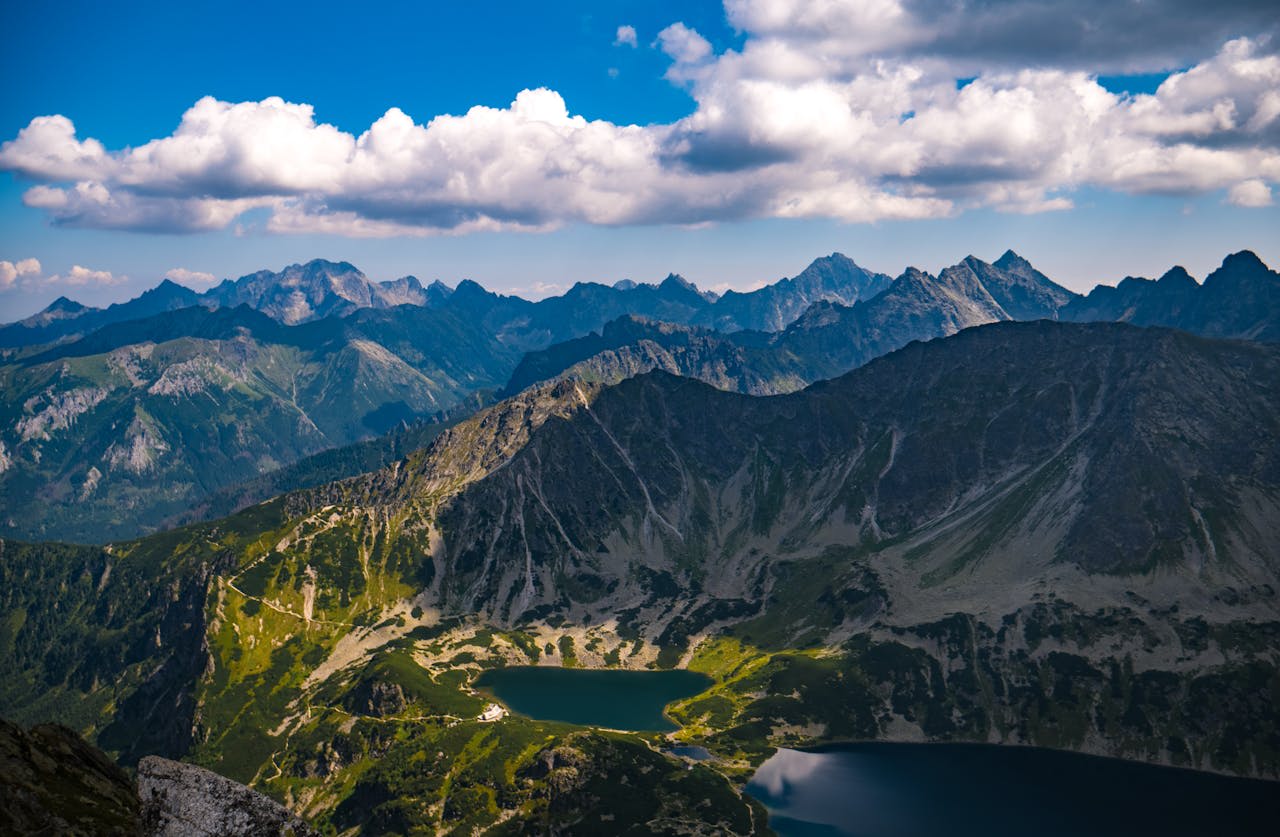
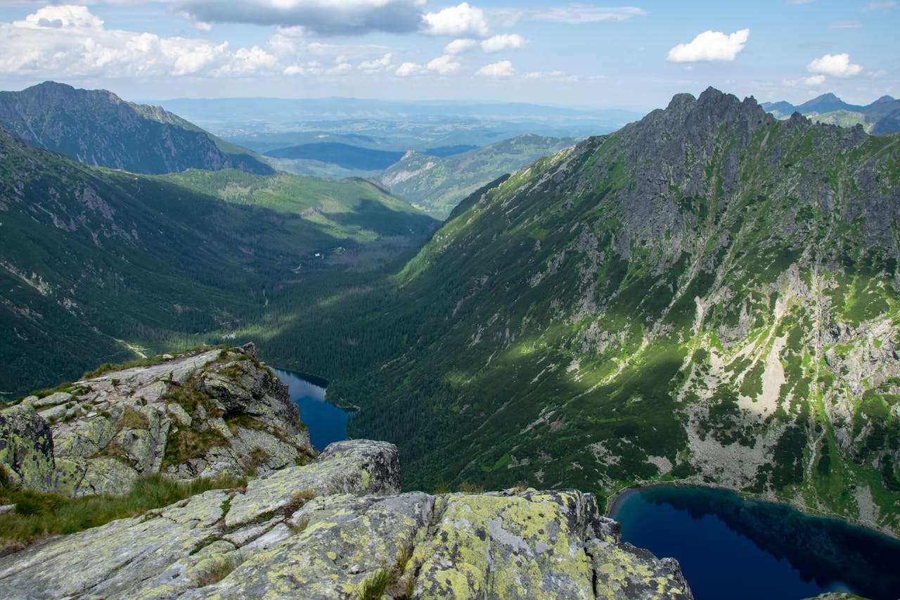
- Morskie Oko Lake: Poland's most visited mountain destination — a 34.9-hectare glacial lake at 1,395 metres, reached by a 9-km marked path or horse-drawn carriage from Palenica Białczańska. The cirque walls rise 700 metres above the lake on three sides, with the rocky ridge of Żabi Koń and Rysy visible from the shore. The smaller Czarny Staw (Black Lake) sits 200 metres above Morskie Oko and can be reached by a steep trail from the main lake shore.
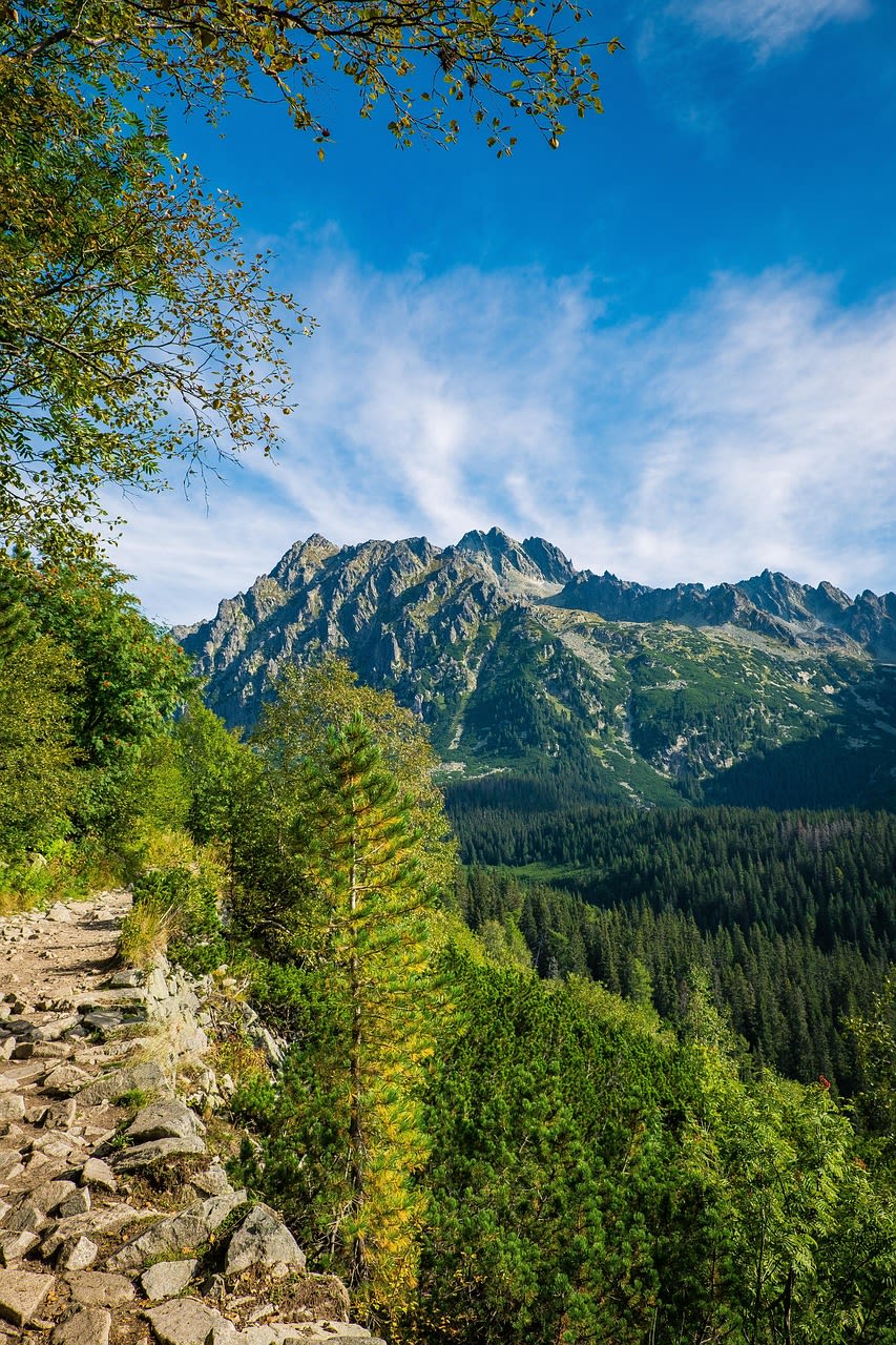
- Orla Perc (Eagle's Path): The most demanding marked trail in the Polish Tatras — a 4.5-km exposed ridge traverse equipped with fixed chains and iron rungs, crossing multiple rocky summits between Zawrat pass (2,159 m) and Krzyżne pass (2,112 m). The route requires experience with exposed terrain and good weather; it is closed when icy and should not be attempted by inexperienced hikers. The views from the ridge are the finest in the Polish Tatras.
- Dolina Kościeliska (Kościelisko Valley): A 7-km limestone valley with a flat floor accessible by an easy path or horse-drawn carriage, featuring karst cave entrances (including the accessible Mylna Cave), a medieval monastery ruin, and the Pisana gorge where the valley narrows between 40-metre limestone walls. The valley floor flora in spring is one of the finest botanical displays in the Tatras.
- Kasprowy Wierch (1,987 m): The most accessible summit in the High Tatras, reached by a cable car from Kuźnice (built 1936). The top station straddles the Polish-Slovak border and serves as the starting point for several difficult ridge routes including the approach to Świnica (2,301 m). The meteorological station on the summit has operated continuously since 1937 and provides the longest continuous mountain climate record in the Polish Carpathians.
📜 History and Cultural Significance
The Tatras were 'discovered' by Polish Romantic intellectuals in the early 19th century, and figures including the poet Adam Mickiewicz and the painter Walery Eljasz-Radzikowski established the range as the Polish national landscape par excellence — the symbol of freedom and natural grandeur for a nation that had no political independence between 1795 and 1918. The Tatra Society (Towarzystwo Tatrzańskie), founded in 1873, built the first mountain huts, mapped the range, and established the tradition of organised mountain tourism that continues today. Zakopane became a major cultural centre in the late 19th century, hosting Stanisław Witkiewicz (creator of the Zakopane Style architecture), Stanisław Wyspiański, and numerous painters, writers, and musicians who shaped the Young Poland artistic movement.
🏃 Activities and Attractions
- Morskie Oko Hike: The most popular walk in Poland — a 18-km return trip from Palenica Białczańska carpark to the lake, ascending 550 metres over a well-maintained wide path suitable for families. Horse-drawn carriages are available for the one-way uphill journey if needed. The final approach to the lake through the boulder-strewn cirque is among the finest mountain walking in Poland.
- Kasprowy Wierch Cable Car and Ridge Walk: Take the historic cable car from Kuźnice to 1,987 metres, then walk west along the ridge toward Czerwone Wierchy — a spectacular 3–4 hour traverse with continuous views into both Poland and Slovakia. The route passes several smaller peaks and the junction with the demanding trail toward Świnica. Return by cable car or continue on foot down to Hala Gąsienicowa.
- Zakopane Town and Górale Culture: Krupówki promenade in Zakopane is the social centre of the Polish mountain world — wooden cafés, folk art shops, and the famous oscypek smoked sheep cheese vendors. The Tatra Museum has excellent exhibitions on highland culture, geology, and the history of mountaineering in the range. The open-air ethnographic museum (skansen) at Szymoszkowa shows traditional Górale farmsteads.
- Winter Skiing: Kasprowy Wierch and the slopes of Gubałówka and Butorowy provide ski terrain for all levels. The Tatras hold reliable snow cover from December to April at altitude, and the resort town infrastructure in Zakopane provides extensive accommodation and après-ski. The FIS Ski Jumping World Cup is held annually at Zakopane's Adam Małysz ski jump arena — the most famous sporting event in the Polish mountains.
- Via Ferrata Climbing: The Tatra National Park maintains several fixed-iron via ferrata routes on limestone cliff sections in the Western Tatras, providing guided exposure to technical terrain without specialist climbing skills. The Kościelisko Valley routes are among the most accessible, with full equipment rental available in Zakopane.
💡 Travel Tips
Best Season: June–September for hiking — all trails open, mountain huts staffed. July–August is peak season with heavy visitor pressure on Morskie Oko. December–March for skiing and winter mountain experience. October for autumn colour in the valley forests and dramatically reduced visitor numbers — the best time for photography of the range.
Trail Regulations: The national park requires visitors to stay on marked trails — off-trail walking is prohibited except on designated routes. Dogs are not permitted in the national park. The Orla Perc and some other exposed routes have mandatory directional flow (walk west to east only) to manage safety on narrow sections. Helmets are recommended on the Orla Perc due to rockfall risk.
Accommodation: Zakopane has extensive accommodation ranging from mountain guesthouses (pensjonat) to large hotels. The mountain huts (schronisko) at Morskie Oko, Hala Gąsienicowa, and Kondratowa allow overnight stays within the park — book months in advance for summer weekends. Kościelisko village (5 km west of Zakopane) is a quieter, more affordable base.
🌱 Conservation
The chamois (Rupicapra rupicapra tatrica) subspecies endemic to the Tatras numbers approximately 250–300 individuals and is considered vulnerable, with the main threats being tourist disturbance on the high ridges during the summer breeding season and competition with red deer (a species not historically present in the Tatras) that has expanded into the range since the 1950s. Joint Polish-Slovak conservation protocols govern the management of large carnivores — bear, wolf, and lynx — whose ranges extend across the international border of the Tatras, requiring coordinated monitoring and conflict resolution with livestock farmers in the surrounding valleys.
