Ring of Kerry
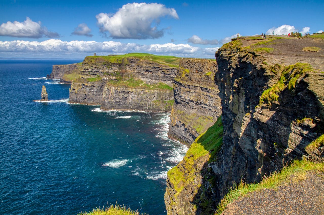
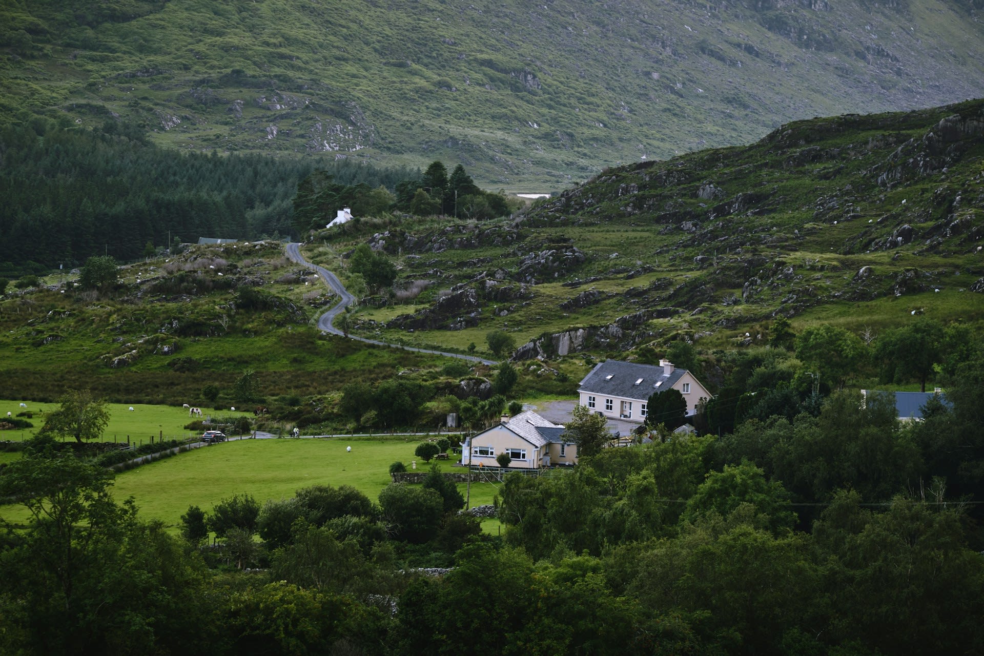
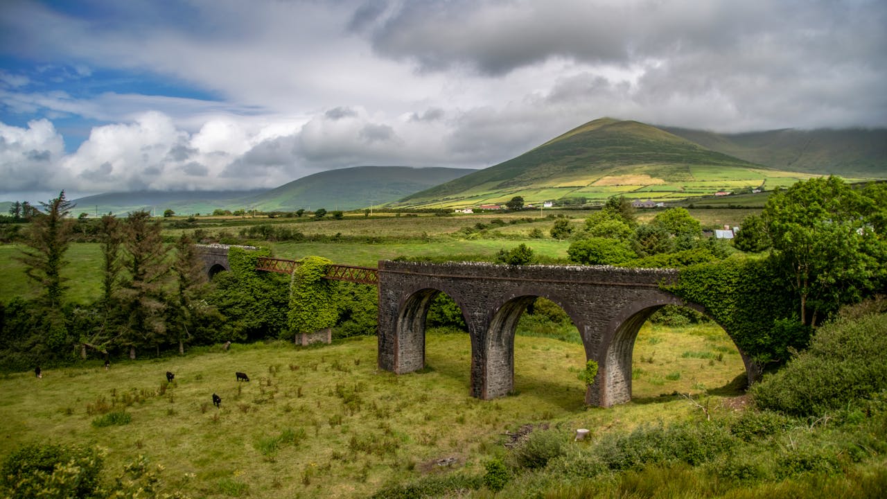
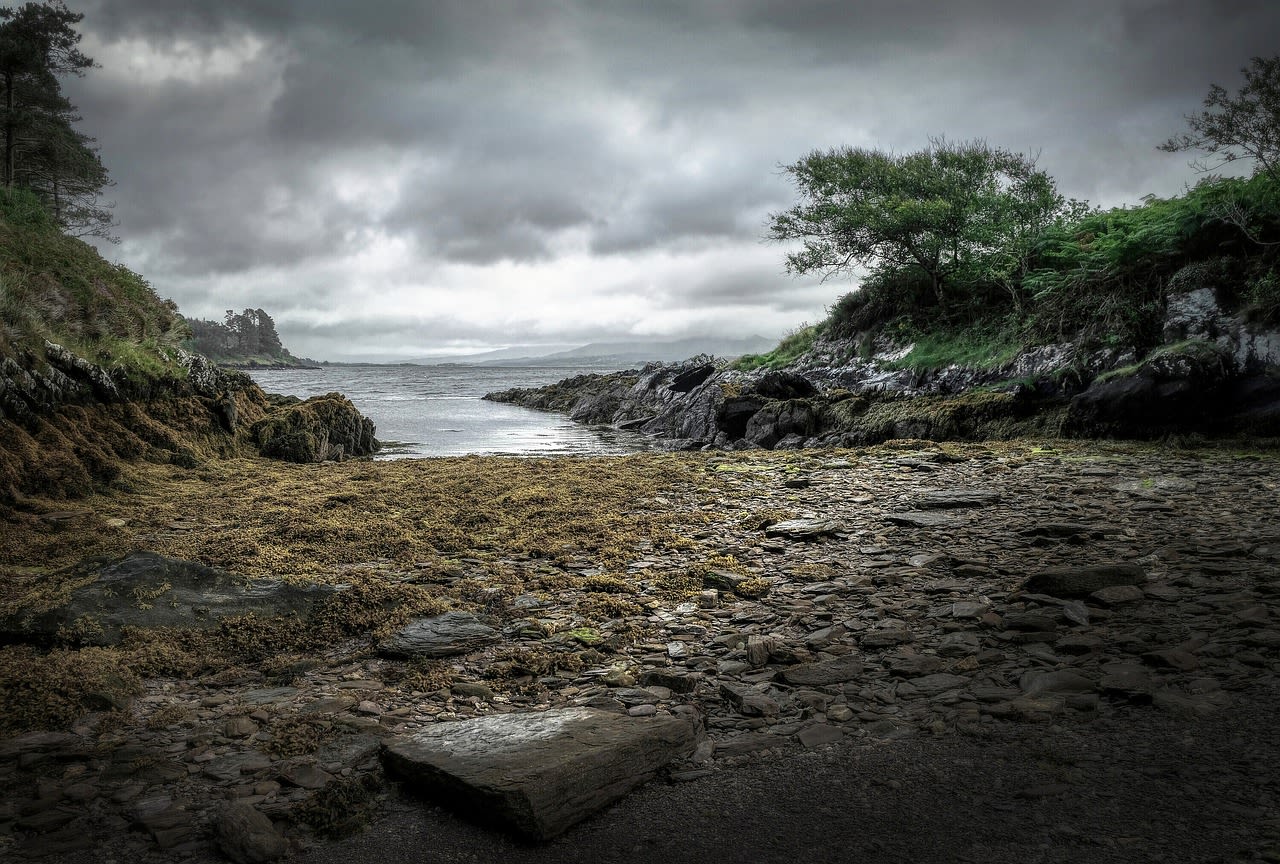
The Ring of Kerry is a 179-kilometre circular scenic drive around the Iveragh Peninsula in County Kerry, southwestern Ireland — widely regarded as one of the most beautiful scenic routes in Europe and among the finest coastal driving experiences in the world. The route traces the perimeter of the peninsula, alternating between mountain passes with panoramic views across Dingle Bay and Kenmare Bay, low Atlantic coastline of wild beaches and rocky headlands, and sheltered river valleys where subtropical gardens thrive in the mild Gulf Stream climate. The Ring encompasses Killarney National Park (Ireland's oldest national park, established 1932), the ancient Staigue Stone Fort, the dramatic Ballaghbeama Gap mountain pass, and the departure points for the UNESCO World Heritage Site of Skellig Michael — an extraordinary monastic complex on a rock pinnacle 11 km offshore, occupied by Christian monks from the 6th to 12th centuries and now home to one of the world's largest Atlantic puffin colonies. The peninsula landscape is shaped by the remnants of Devonian Old Red Sandstone mountains rising to 1,038 metres at Carrauntoohil (Ireland's highest peak, just north of the Ring) and the pervasive influence of the North Atlantic Gulf Stream, which keeps Kerry frost-free and supports rare subtropical and Atlantic oak woodland communities.
🌍 Geography and Ecosystem
- Killarney National Park: Ireland's first national park (1932) covers 102 km² of mountain, lake, and woodland at the eastern end of the Iveragh Peninsula. The three Killarney Lakes (Lough Leane, Muckross Lake, and Upper Lake) are famous for their beauty, set against the backdrop of the MacGillycuddy's Reeks and surrounded by the largest surviving area of native Atlantic oak woodland in Ireland. The park supports Ireland's only wild red deer herd, white-tailed sea eagles (reintroduced 2007), and the only known Irish population of Kerry slug — an Iberian-Atlantic species isolated here since the post-glacial period.
- Skellig Michael (UNESCO World Heritage): A 218-metre rock pinnacle 11 km offshore from Portmagee, with a 6th-century Christian monastery clinging to its summit — a site of extraordinary spiritual audacity. The monks carved 618 stone steps up the cliff face and constructed beehive (corbelled) stone huts that have survived 1,400 years of Atlantic storms without mortar. Landing on Skellig Michael requires advance permit booking, calm weather, and boat passage from Portmagee or Ballinskelligs. The island's inaccessibility has made it one of the finest seabird sanctuaries in Europe, with over 30,000 breeding Atlantic puffins.
- Staigue Stone Fort: One of Ireland's best-preserved Iron Age stone forts, a circular dry-stone enclosure approximately 2,500 years old with walls 4 metres high and 4 metres thick, standing in an isolated valley 3 km off the main Ring road near Castlecove. The quality of the drystone masonry — no mortar, perfectly courses stones — and the complexity of the internal stairway and terrace system is remarkable for a structure of this age.
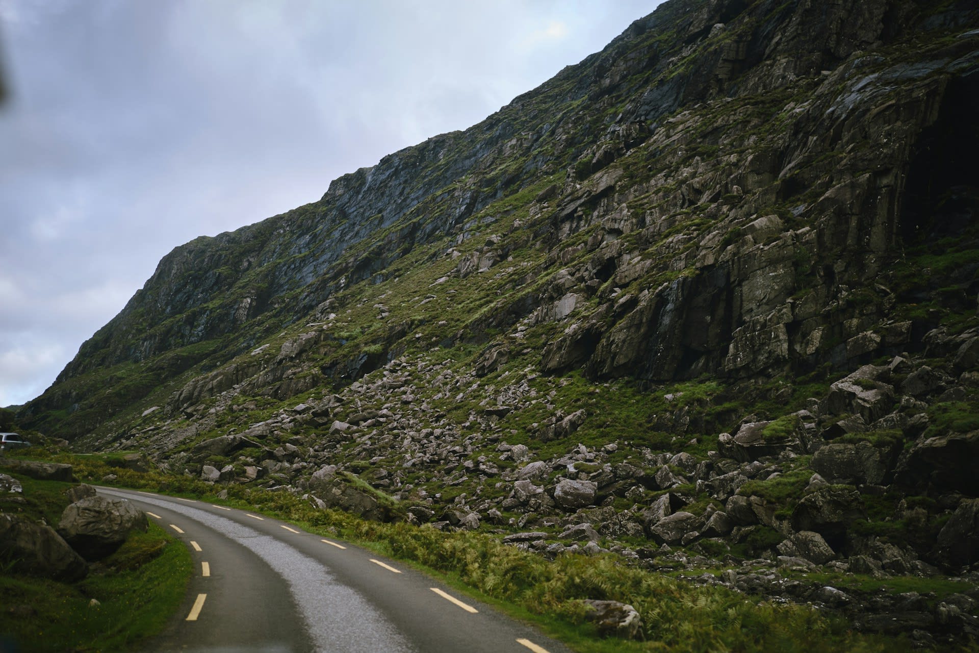
- Ballaghbeama Gap: A dramatic mountain pass cutting through the MacGillycuddy's Reeks on a narrow single-track road, passing through landscape of bare sandstone ridges and bog that feels genuinely remote despite being only 10 km from Killarney. The pass is not part of the official Ring road (which circuits the peninsula coast) but is one of the finest mountain driving experiences in Ireland.
📜 History and Cultural Significance
The modern Ring of Kerry as a tourist route was largely created by the Great Southern Railway Company in the 1890s, which developed the Killarney–Kenmare coach route to attract wealthy Victorian tourists completing the 'Irish Tour.' Queen Victoria's 1861 visit to Killarney established the area's aristocratic tourism credentials, and the Ladies View viewpoint over the Upper Lake was named after her ladies-in-waiting, who reportedly stood in silent admiration of the panorama. The Great Famine (1845–52) devastated the peninsula's population — County Kerry lost an estimated 30% of its pre-Famine inhabitants to death and emigration, and many of the stone-walled field systems visible from the Ring road are relics of pre-Famine smallholdings that were never repopulated after clearance.
🏃 Activities and Attractions
- Skellig Michael Boat Tour: The boat journey from Portmagee or Ballinskelligs to Skellig Michael (45–60 min) passes through some of the most dramatic open Atlantic water accessible by passenger vessel in Ireland. Landing on the island requires advance booking through the Heritage Ireland permit system — permits are limited to 180 visitors per day and are extremely competitive. The climb of the 618 ancient stone steps to the monastery takes 30–45 minutes and is not suitable for those with vertigo or mobility limitations. The views of the monastery buildings, with the open Atlantic 210 metres below, are among the most profound in Ireland.
- Kerry Way Long-Distance Walk: The 214-km Kerry Way walking route circuits the Iveragh Peninsula on a network of ancient roads, mountain paths, and forest tracks — the equivalent of the Ring of Kerry for walkers. The complete circuit takes 9–10 days and passes through Killarney, Kenmare, Sneem, Waterville, Caherciveen, and Glenbeigh, with accommodation in small guesthouses and farm B&Bs along the route. Day sections can be walked independently using public transport returns.
- Killarney National Park Activities: Jaunting car (horse-drawn carriage) rides from Killarney town through the national park to Ross Castle and Muckross House are a traditional Kerry experience. The park's network of walking and cycling trails includes the 17-km Old Kenmare Road through the Mangerton Valley and the lakeside paths of the Muckross Peninsula, where the native oak woodland is at its most impressive.
- Sea Kayaking the Skellig Coast: Guided sea-kayaking expeditions from Caherciveen and Portmagee explore the Atlantic coastline of the outer Iveragh Peninsula, including sea caves, tidal races, and close approaches to the smaller Skellig (Little Skellig), whose gannet colony of 70,000 birds is the second-largest in the world and can be approached by kayak to within 50 metres.
- Surfing at Inch Beach: Inch Beach, at the northern base of the Iveragh Peninsula on Dingle Bay, is a 5-km tombolo (sandbar) providing excellent surf conditions for beginners and intermediate surfers. Several surf schools operate from the beach, and the views down Dingle Bay to the Slieve Mish Mountains make it one of Ireland's most scenic surf locations.
💡 Travel Tips
Best Season: May–September for reliable weather and all activities including Skellig Michael boat access. June–July for the longest evenings and puffin season on Skellig Michael. October and April for dramatic landscapes and minimal tourist traffic. The Ring is driveable year-round but mountain sections may close briefly in severe winter weather.
Skellig Michael Booking: Boat licences and landing permits are strictly controlled. Book as early as possible — many popular operators open their booking systems in January for the summer season. Boats depart only in calm weather (Beaufort Force 4 or below). Have a backup day built into your itinerary as cancellations due to weather are common.
Driving Tips: The Ring roads are narrow with passing places, particularly between Glenbeigh and Waterville. Drive slowly and use the passing places generously. The Moll's Gap mountain road section between Killarney and Kenmare is particularly narrow and scenic — avoid it at peak coach tour times (10am–3pm in July–August).
🌱 Conservation
The Skellig Michael visitor management system is globally cited as a model for balancing access to fragile heritage with conservation requirements. The strict daily permit limit of 180 visitors, the prohibition on picnicking or removing any material, and the requirement for Heritage Ireland guides to accompany all visitor groups have maintained the integrity of the 1,400-year-old stone structures while allowing a meaningful visitor experience. Atlantic puffin populations on the Skellig Islands are monitored annually; in contrast to many UK and Irish colonies, the Skellig numbers have remained relatively stable, possibly because the islands' remoteness has shielded them from the worst effects of sand-eel decline.