Cliffs of Moher
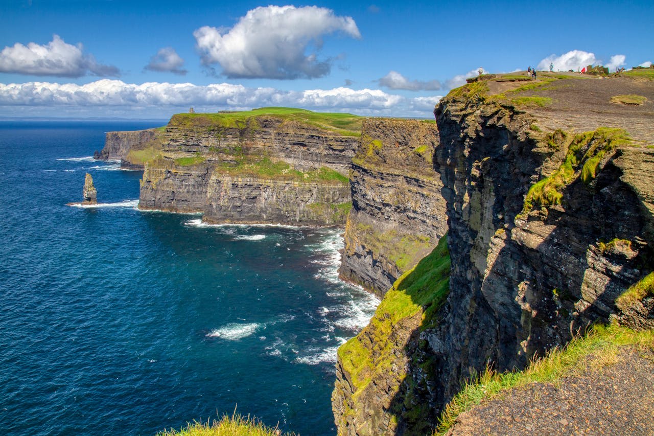
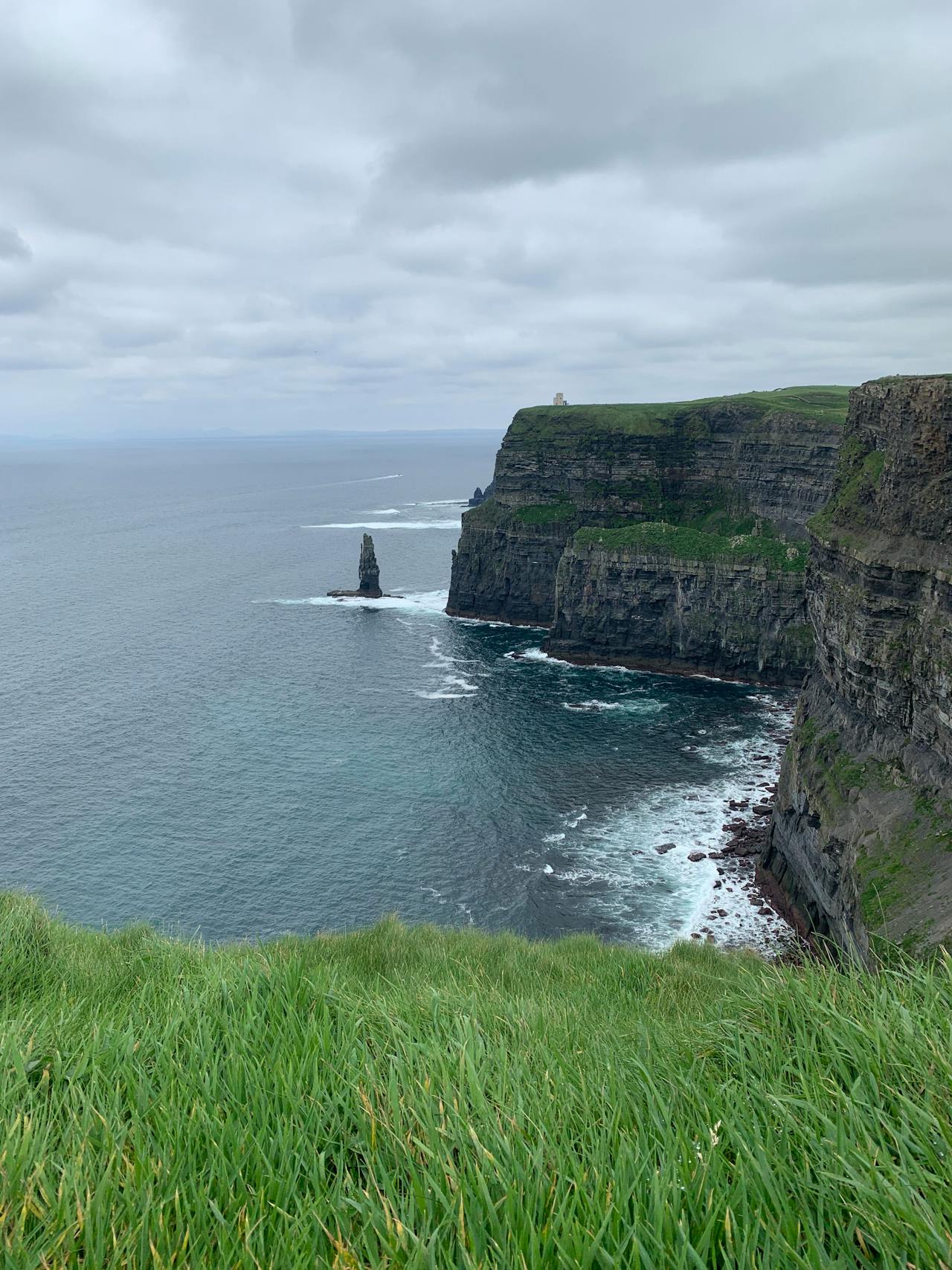
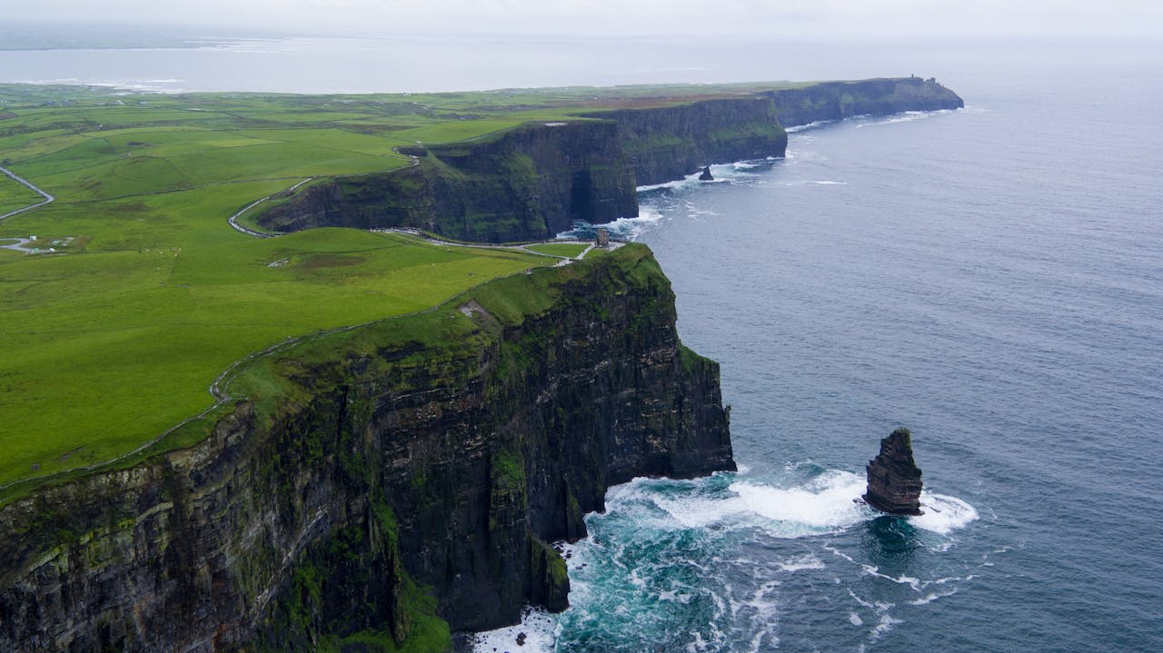
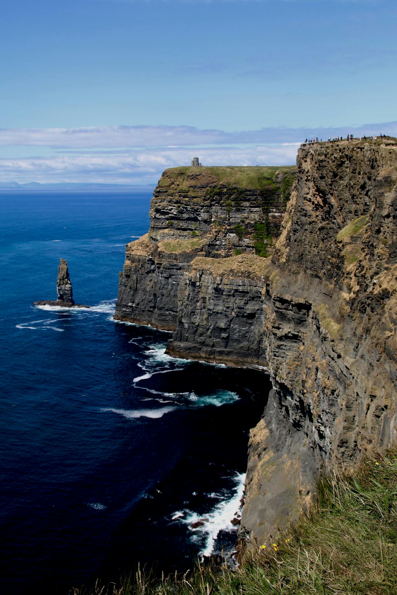
The Cliffs of Moher (Irish: Aillte an Mhothair) are Ireland's most visited natural landmark and one of the most iconic sea cliff formations in Europe — a 14-kilometre wall of Carboniferous sandstone, siltstone, and shale rising to a maximum height of 214 metres above the crashing North Atlantic at Knockardakin, in County Clare on Ireland's Wild Atlantic Way. The cliffs are the exposed edge of a horizontal rock sequence that accumulated in river delta and shallow marine environments approximately 320 million years ago during the Carboniferous period, and the bedding layers are clearly visible in the near-vertical cliff faces — each band representing a distinct depositional episode. Designated a UNESCO Global Geopark as part of the Burren and Cliffs of Moher Geopark in 2011, the cliffs form the Atlantic edge of the Burren limestone karst plateau and attract over 1.5 million visitors annually. On clear days, the Aran Islands are visible 7 km offshore, their own Carboniferous limestone platforms rising from the sea in a direct geological continuation of the Burren.
🌍 Geography and Ecosystem
- Seabird Colonies: The cliffs host approximately 30,000 breeding seabirds in summer (May–July), including the largest Atlantic puffin colony in Ireland (approximately 8,000 pairs), guillemot, razorbill, kittiwake, fulmar, and peregrine falcon. The noise and smell of the guillemot colonies on the central cliff sections between Hag's Head and O'Brien's Tower is a genuinely overwhelming sensory experience at the height of the nesting season.
- O'Brien's Tower: A round tower built in 1835 by local landowner Cornelius O'Brien as a viewing point for Victorian tourists — one of Ireland's first purpose-built tourist infrastructure projects. Standing on the highest accessible point of the cliff edge (204 metres), it provides the most comprehensive view of the cliff arc and the Aran Islands beyond. The flagpole on the tower roof flew the tallest flag in Ireland on Victoria's coronation day.
- Hag's Head (Ceann Caillí): The southern terminus of the main cliff stretch, where the cliff profile is lower (50–80 m) but the isolation is greater and visitor numbers minimal. The ruins of a Napoleonic-era signal tower stand on the headland, and the rock platform at the base is accessible at low tide via a steep path — one of the only sea-level access points along the entire cliff line. Excellent for photographing the cliffs from below.
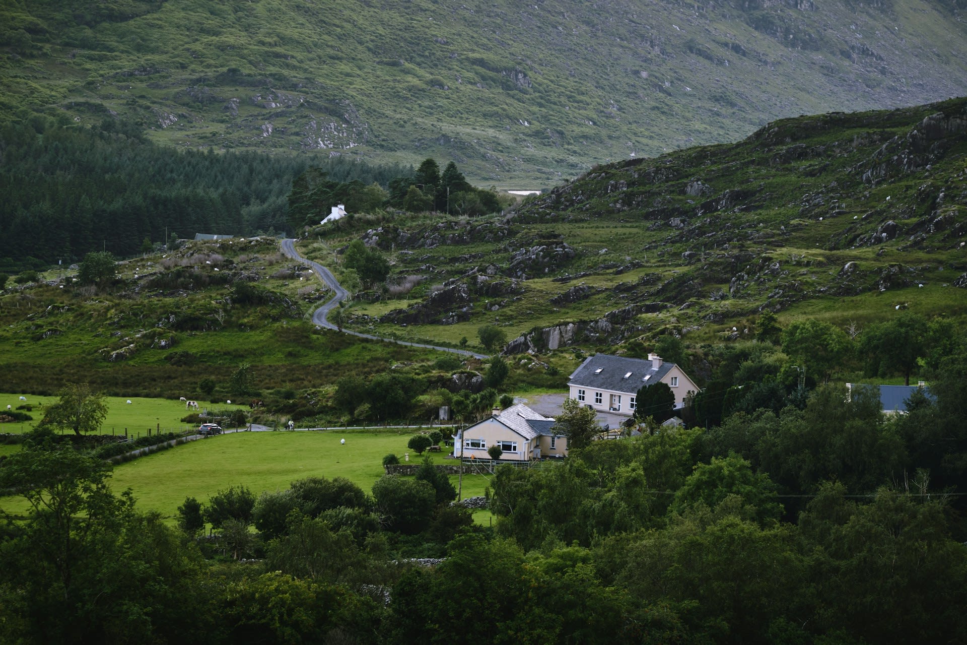
- Burren National Park (adjacent): Immediately east of the cliffs, the Burren limestone karst plateau is a globally unique landscape of bare rock pavement, stone-walled meadows, and an extraordinary flora combining Arctic, Alpine, and Mediterranean species in the same pavement cracks. Over 70% of Ireland's native plant species occur in the Burren, which covers 530 km² of County Clare and County Galway.
📜 History and Cultural Significance
The cliffs gained wider European attention through the writings of the German naturalist Heinrich Gottfried Hempel, who visited in 1820, and through the paintings of the Irish artist William Turner of Oxford (not to be confused with J.M.W. Turner), who depicted the cliffs in dramatic Romantic style in the 1830s. The construction of O'Brien's Tower in 1835 formalised their status as a tourist attraction during the early Victorian era. The cliffs achieved global cultural recognition through their use as a filming location in numerous productions including The Princess Bride (1987) and Harry Potter and the Half-Blood Prince (2009), introducing them to audiences far beyond Ireland's traditional tourism markets.
🏃 Activities and Attractions
- Cliff Walk: The primary visitor experience follows a 7-km marked path along the cliff edge from Hag's Head in the south to the northern end of the managed zone, passing O'Brien's Tower and multiple viewpoints. The northern extension to Doolin village (additional 4 km) follows an unmaintained path across the cliff-top grassland and requires appropriate footwear and weather preparedness. The full Hag's Head to Doolin route (18 km round trip) is one of the finest coastal walks in Ireland.
- Boat Tours from Doolin and Liscannor: Year-round boat tours from Doolin pier (5 km north) pass beneath the full height of the cliffs at sea level, providing a perspective impossible from the top. The best time is summer morning calm — the Atlantic swell can make landings rough in afternoon or in winter. Several tours combine the cliffs with a visit to the Aran Islands (30-minute boat crossing).
- Puffin Watching: The Atlantic puffin colony at the northern cliffs is accessible from the cliff path between April and July. Puffins nest in burrows in the cliff-top turf and are most visible in the early morning and evening when returning from fishing trips with sand-eels in their distinctive colourful beaks. Bring binoculars for best views from the safety fence.
- Burren Day Trip: Combining the Cliffs of Moher with a drive through the Burren limestone landscape — the Corkscrew Hill road to Ballyvaughan, the Poulnabrone portal tomb (c. 3800 BCE), and the Ailwee Cave stalactite system — creates a full-day itinerary through one of Ireland's most geologically and botanically extraordinary regions.
- Visitor Centre Atlantic Edge Exhibition: Built underground into the cliff-side to minimise visual impact, the award-winning visitor centre contains the Atlantic Edge exhibition with interactive geology, ecology, and cultural heritage displays. Entry is included with the site admission fee (approximately €8 in 2024) which funds cliff conservation and path maintenance.
💡 Travel Tips
Best Season: May–July for puffin and seabird nesting, long Atlantic evenings, and most reliable weather. October–November for dramatic storm swells and moody low light. Christmas week is very quiet. July–August are the busiest months — arrive at opening time (9am) to secure parking. Sunset visits (late May onwards, sunset after 9pm) are magical and less crowded than midday.
Weather: Atlantic weather is extremely variable year-round. Strong gusts are a serious safety hazard on the cliff edge — the wind at the cliff top is typically 15–20 km/h faster than at the carpark level. Never approach the cliff edge in gusts exceeding 40 km/h or when it is wet, as the grass is extremely slippery. Stay behind the safety barriers.
Accommodation: Doolin village (5 km north) is the most atmospheric base, with traditional music in multiple pubs every night. Lahinch (10 km south) has a wide range of hotels and self-catering. Ennis (30 km east) provides urban amenities and the widest hotel choice in County Clare.
🌱 Conservation
The seabird colonies are monitored annually by BirdWatch Ireland as part of the national Seabird Monitoring Programme. Puffin numbers have declined nationally by approximately 30% since the 1990s, driven by the collapse of sand eel populations linked to warming sea temperatures and industrial sand eel fishing in the North Sea. The Moher colony has fared better than many in Ireland, but its long-term status depends on oceanographic factors beyond local management control. The adjacent Burren and Cliffs of Moher UNESCO Global Geopark provides the management framework for the wider landscape context, coordinating geological heritage interpretation, sustainable tourism, and land management across the 530-km² Burren karst zone.