
Grossglockner Alpine Road
The Grossglockner High Alpine Road, known as Grossglockner-Hochalpenstraße in German, is one of Austria's most iconic and breathtaking routes. Spanning 48 kilometers (30 miles), this high-altitude road traverses the Hohe Tauern National Park and offers spectacular views of the Alps, including the majestic Grossglockner, Austria's highest peak. The road is renowned for its stunning scenery, dramatic mountain passes, and a variety of natural and cultural attractions. This guide provides an in-depth look at the Grossglockner High Alpine Road, covering its geography, history, activities, travel tips, conservation efforts, and visitor experiences.
🌍 Geography and Natural Features
The Grossglockner High Alpine Road is renowned for its dramatic alpine landscape, offering unparalleled views and access to diverse natural features.
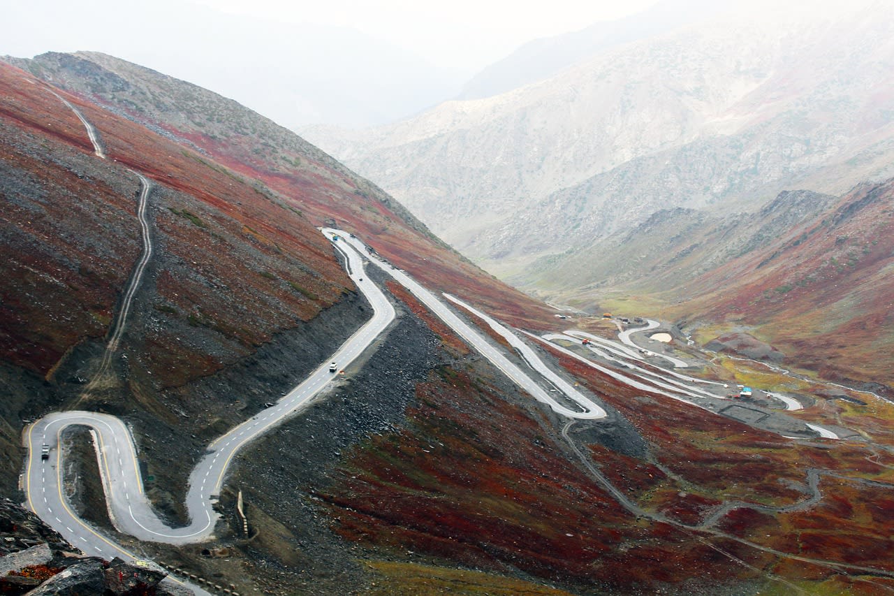
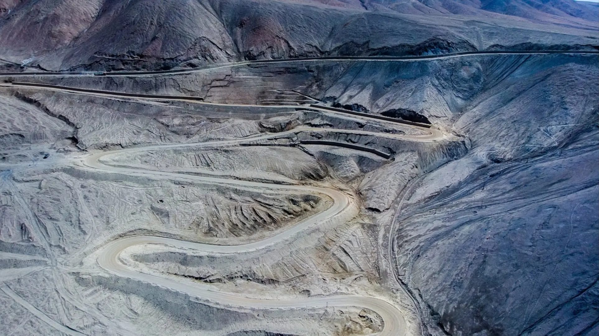
- Route Overview: The Grossglockner High Alpine Road stretches from the town of Bruck an der Glocknerstraße in the north to Heiligenblut in the south. The road reaches an elevation of 2,504 meters (8,216 feet) at the highest point, known as the Edelweißspitze. The route traverses through several climatic zones, from lush valleys to alpine meadows and rugged mountain peaks.
- Grossglockner Peak: The road provides stunning views of the Grossglockner, Austria's highest mountain, which rises to 3,798 meters (12,461 feet). The peak is part of the Glockner Group in the Hohe Tauern range and is a prominent feature along the route, visible from various vantage points.
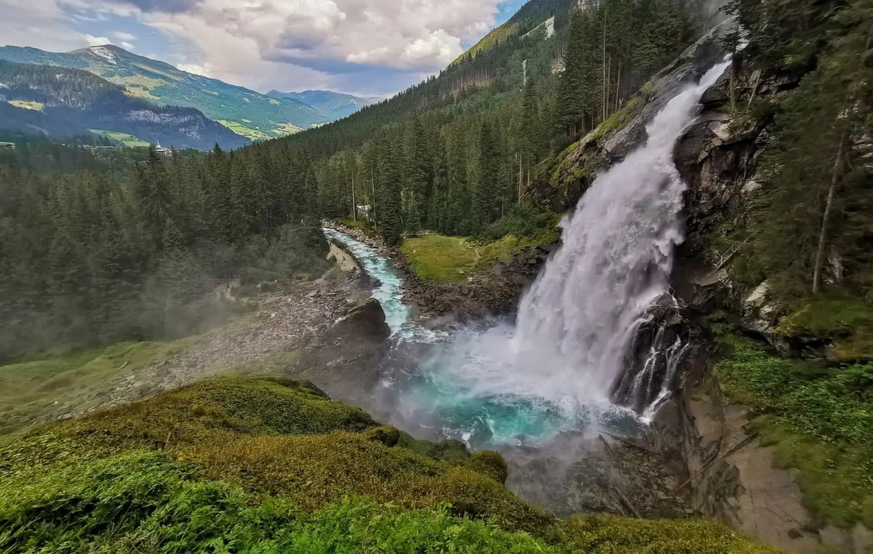
- Glaciers and Waterfalls: The road passes by several glaciers, including the Pasterze Glacier, which is the longest glacier in Austria. Visitors can also view various waterfalls cascading down the mountain slopes, such as the impressive Fallbach Falls, which is one of the highest waterfalls in Austria.
📜 History and Construction
The Grossglockner High Alpine Road has a rich history that reflects its role in tourism, engineering, and regional development.
Construction and Development: The construction of the Grossglockner High Alpine Road began in 1930 and was completed in 1935. The road was built to promote tourism and improve accessibility to the alpine region. It was a significant engineering achievement of its time, involving extensive roadwork through challenging terrain and high-altitude conditions.
Historical Significance: The road was designed to highlight the natural beauty of the Hohe Tauern National Park and the Grossglockner peak. It became a popular destination for tourists, drawing visitors from around the world to experience the stunning alpine scenery. The road also played a role in the development of the surrounding region, boosting local tourism and economy.
Cultural Impact: The Grossglockner High Alpine Road has become an iconic symbol of Austria's alpine heritage. It has inspired artists, writers, and photographers, contributing to its cultural significance. The road is celebrated for its role in showcasing the natural beauty of the Austrian Alps and promoting environmental awareness.
🏃 Activities and Attractions
The Grossglockner High Alpine Road offers a variety of activities and attractions for visitors to enjoy, from scenic drives to outdoor adventures.
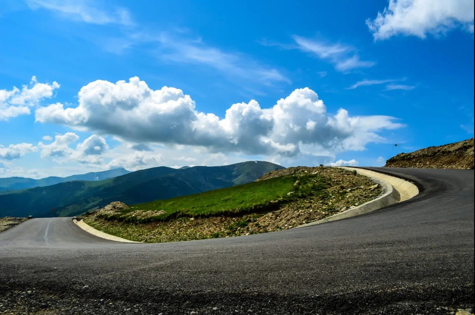
- Scenic Drives: The road itself is a major attraction, providing a spectacular driving experience with numerous viewpoints and photo opportunities. Drivers can enjoy the winding roads, switchbacks, and panoramic vistas that make the journey unforgettable. Several designated parking areas allow visitors to stop and take in the views.
- Hiking and Nature Trails: The road provides access to several hiking trails and nature walks within the Hohe Tauern National Park. Popular hikes include the trail to the Kaiser-Franz-Josefs-Höhe viewpoint, which offers stunning views of the Grossglockner and the Pasterze Glacier. Other trails lead to alpine meadows, glacial lakes, and picturesque valleys.
- Visitor Centers and Exhibits: Along the road, visitors can find several information centers and exhibits, including the Grossglockner Visitor Center at the Kaiser-Franz-Josefs-Höhe. These centers offer educational displays about the region's geology, wildlife, and history, as well as interactive exhibits and guided tours.
💡 Travel Tips
To ensure a smooth and enjoyable visit to the Grossglockner High Alpine Road, consider these practical travel tips.
Best Time to Visit: The road is typically open from early May to late October, depending on weather conditions and snowfall. The summer months (June to September) are the best time to visit for favorable weather and clear views. The road may be closed during the winter due to snow and ice, so it is important to check road conditions before planning your trip.
Access and Transportation: The road is accessible by car or motorcycle. It is advisable to drive a vehicle with good brakes and tires, as the road features steep gradients and tight curves. Public transportation options are limited, so traveling by private vehicle is recommended for the full experience. Parking is available at various viewpoints and visitor centers along the route.
What to Bring: Bring warm clothing, as temperatures can be chilly at higher elevations even in summer. Carry a camera to capture the stunning landscapes, and bring binoculars for wildlife viewing. If planning to hike, bring appropriate footwear, a map, and sufficient water and snacks.
🌱 Conservation
Conservation efforts along the Grossglockner High Alpine Road focus on preserving the natural environment and managing the impact of tourism.
Environmental Protection: Measures are in place to protect the delicate alpine ecosystem and minimize environmental impact. This includes maintaining the road infrastructure, managing visitor flow, and implementing guidelines for responsible behavior. Efforts are made to prevent pollution, erosion, and damage to natural habitats.
Wildlife Conservation: The Hohe Tauern National Park, through which the road passes, is home to a diverse range of wildlife, including marmots, chamois, and ibex. Conservation programs aim to protect these species and their habitats from disturbances caused by tourism and other human activities.
Sustainable Tourism: To promote sustainable tourism, visitors are encouraged to follow guidelines for responsible behavior, such as staying on designated paths, avoiding littering, and respecting wildlife. Educational programs and signage help raise awareness about the importance of preserving the natural beauty of the region.
✨ Conclusion
The Grossglockner High Alpine Road is a remarkable destination that showcases the beauty and grandeur of the Austrian Alps. With its dramatic mountain scenery, diverse natural features, and well-preserved environment, the road offers an unforgettable experience for travelers seeking adventure and natural splendor. Conservation efforts ensure that the road remains a pristine and accessible route while allowing visitors to appreciate the breathtaking landscapes and cultural heritage of the region. A journey along the Grossglockner High Alpine Road promises a memorable exploration of Austria’s alpine wonders and an opportunity to connect with the natural world.