


Coron
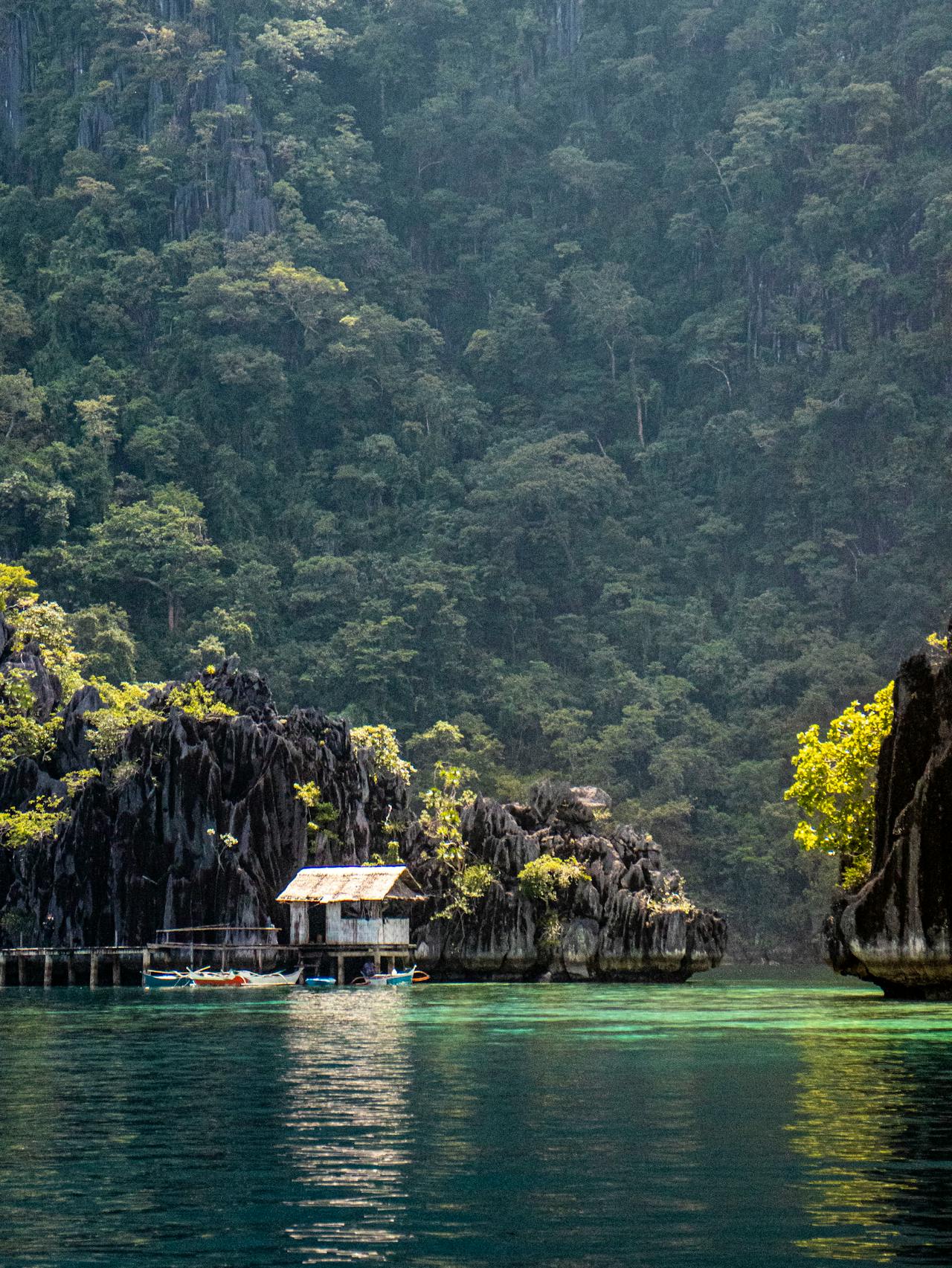
Coron is the main town on Busuanga Island in northern Palawan province, Philippines — a frontier of karst limestone islands, coral reefs, and the remnants of a Japanese naval fleet sunk by US aircraft on 24 September 1944 in one of the largest air raids of the Pacific War. The 24 Japanese supply ships lying on the sea floor of Coron Bay at depths of 10–45 metres form one of the world's great wreck diving destinations — the ships are overgrown in hard and soft coral, inhabited by enormous schools of fish, and large enough (the largest is 150 metres long) to penetrate safely through cargo holds and engine rooms. Above water, Coron's karst landscape delivers freshwater lakes enclosed within limestone cliffs — Kayangan Lake, rated among Southeast Asia's most beautiful, sits inside a karst bowl visible from a cliff-top viewpoint of extraordinary drama. The island group including Busuanga, Coron Island, and the Calamian Islands is a nature reserve of 50,000+ hectares protecting mangrove, seagrass, and reef ecosystems. Coron's population includes the Tagbanwa indigenous people — one of the Philippines' oldest indigenous groups — whose ancestral territory includes Coron Island's lakes and forest.
🌍 Geography and Ecosystem
- Japanese WWII Shipwrecks: On 24 September 1944, 96 US Navy planes from Task Force 38 surprised the Japanese supply fleet at anchor in Coron Bay, sinking 24 ships in a 45-minute attack. The fleet — resupply ships, oilers, and escort vessels carrying fuel, ammunition, and supplies for the Philippine campaign — settled on the bay floor at depths of 10–45 metres, where 80 years of coral growth have converted them into the world's most elaborate artificial reef system. The Okikawa Maru (145 m oil tanker), Kogyo Maru (cargo ship with cargo cranes still intact), and Akitsushima (seaplane tender with a seaplane crane visible) are the most impressive.
- Kayangan Lake: A freshwater lake enclosed within a karst bowl on Coron Island, accessible via a 150-step staircase over the limestone ridge from a dock on the sea coast. The lake — fed by underground springs through the limestone — is of extraordinary clarity (visibility 10–15 m in the freshwater layer) and a unique stratified chemistry: fresh water overlies salt water from sea infiltration at the lake floor, creating a thermocline visible as an undulating refractive boundary at 3–5 m depth. The cliff-top view before the descent — looking down at the luminous turquoise lake enclosed by grey karst walls — is one of Southeast Asia's most celebrated viewpoints.
- Twin Lagoon: Two interconnected lagoons on Coron Island — the outer accessible at all times by boat, the inner accessible only through a narrow tunnel in the limestone wall at low to mid tide (swimming or kayaking). The inner lagoon is completely enclosed, strikingly warm (the limestone walls trap heat), and of astonishing turquoise colour. The tunnel swim between lagoons is a distinctive adventure available to all swimmers regardless of diving experience.
- Barracuda Lake: A second lake on Coron Island with a unique thermal stratification — the lake is warm (38°C) in the lower layers due to geothermal activity, creating a pronounced thermocline between the cooler upper water and the very warm lower water. Large barracuda (1–1.5 m) are habituated to divers and swim in lazy circuits through the clear water. The lake is accessible to both snorkellers and divers — the thermocline at 3–4 m is dramatically visible.
📜 History and Cultural Significance
The Japanese naval presence at Coron Bay was part of the broader Pacific War strategic contest for control of Philippine waters. The Japanese had used Coron Bay as a safe anchorage for supply ships supporting the garrison throughout the Philippines — its sheltered waters, remote location, and the absence of Allied air cover made it appear secure. The US attack on 24 September 1944 — codenamed Operation King II — was a demonstration of the newly extended range of carrier aviation and a significant blow to Japanese resupply logistics in the Philippines. The wrecks became a diving destination from the 1980s when technical diving capability developed sufficiently to penetrate the deeper and more complex vessels.
🏃 Activities and Attractions
- Wreck Diving at Coron Bay: The pinnacle activity for certified divers — guided wreck dives on the Japanese WWII fleet at depths of 10–45 metres. Open water divers can access the shallower wrecks (Akitsushima, Skeleton Wreck); advanced divers penetrate the larger vessels (Okikawa Maru, Kogyo Maru) through cargo holds and engine rooms where schooling batfish, lionfish, and nudibranchs inhabit the coral-encrusted superstructure. Night dives on the wrecks (sleeping reef sharks, feeding octopus) are an advanced option from dive operators in Coron town.
- Island Hopping and Lake Tour: The standard Coron tour combining Kayangan Lake, Twin Lagoon, Barracuda Lake, CYC Beach, and the Coral Garden snorkel site in a full day by bangka. The combination of freshwater lake swimming, saltwater lagoon tunnelling, and reef snorkelling in a single day provides a complete Coron experience accessible to non-divers. Kayangan Lake's cliff-top viewpoint before the descent is the tour's visual highlight.
- Kayaking in the Calamianes: The Calamian Islands surrounding Coron — Culion, Linapacan, and the outer islands — offer multi-day kayaking expeditions through uninhabited limestone karst and pristine reef systems with very few tourists. Outfitters in Coron town offer supported kayaking expeditions of 3–7 days sleeping in tents or bangka motherships, accessing reef snorkelling and cave systems without the day-tripper presence of the main Coron sites.
- Snorkelling at Coral Garden and CYC Beach: Non-diving reef snorkelling at the Coral Garden off Busuanga's south coast and the shallow reef of CYC (Coron Youth Club) Beach provides good encounters with healthy coral, sea turtles, and reef fish accessible to confident swimmers. Both sites are included in standard island hopping tours. The sea grass beds between the karst islands are feeding grounds for dugong — sightings are rare but the area is part of the Palawan Sea's dugong range.
- Coron Town Viewpoint at Sunset: A 30-minute climb up 724 steps to the viewpoint above Coron town provides a panoramic view of Coron Bay, the limestone karst islands, and the open sea beyond — one of the Philippines' finest sunset viewpoints. The town below — a functional fishing and tourism community of traditional wooden houses, tricycles, and bangka-lined waterfronts — is as much a part of the Coron experience as the natural sites.
💡 Travel Tips
Best Season: November–May for dry, calm conditions ideal for diving, snorkelling, and island hopping. March–May is peak diving season with the best underwater visibility (20–30 m) but the highest accommodation prices. June–October is the wet season and typhoon risk period — many dive operators reduce operations, but the islands are dramatically less crowded and accommodation discounts are significant. Check typhoon forecasts carefully in September–October.
Accommodation: Coron town on Busuanga Island has the widest range — backpacker guesthouses, mid-range hotels, and several boutique resorts. Coron Island itself has no accommodation — the Tagbanwa ancestral domain prohibits overnight stays by non-community members. Several resort islands within the bay (Club Paradise on Dimakya Island, Sangat Island Dive Resort) offer exclusive island resorts for those seeking privacy over convenience.
🌱 Conservation
The Tagbanwa Foundation's management of Coron Island — controlling access to the lakes and maintaining the forest interior as a no-tourism zone — has been one of the Philippines' most effective examples of indigenous-led conservation. The income from lake access fees (approximately 10 million pesos annually) funds community infrastructure and education. The ancestral domain claim and the legal recognition of Tagbanwa rights over Coron Island have been critical to preventing the large-scale resort development that has transformed other Philippine island destinations.